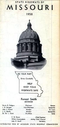
On its front cover (above), the 1950 state highway map featured a rather plain photograph of the dome of the State Capitol, a safety message surrounded by an outline of the state, and a list of highway commission members. There's no hint that the state map inside is in color.
The official 1950 Missouri highway map was the first one to be typeset rather than drawn by hand. It still maintained the practice from earlier years of using the Missouri state outline for numbered state highways (for which later maps used a plain circle) and all upper-case type.
The insets were still hand-drawn, and would continue to be until the 1952 official map was released. This map style was used through 1953.
From this page, you can access fair use excerpts of the map. It is in excellent condition.
Note: These are huge scans, running around 400 to 550 KB in size. Such large file sizes were necessary in order to show the detail that this map provides. The areas shown by the scans overlap.
Inset Maps
Included around the margins of the map were inset maps for 38 cities, including St. Louis and Kansas City, of course, but also including quite a few smaller cities in the state. In subsequent years, some official maps continued with the insets, while others such as the 1956 map didn't. The last official map with an extensive collection of inset maps was the 1969 map.
The following cities had inset maps on the 1950 map (fair use excerpts):