Welcome to the US Highways Signs and Sights Gallery! This page lists the most recent additions and changes that have been made. They're categorized by the date they were added.
November 9, 2024
Some additional cleanup, including replacing links to my former Twitter feed with links to my Mastodon feed.October 28, 2024
I have moved from California and am now in Colorado. I will be doing some clean-up work on the site and hope to make it easier to manage.March 8, 2020
Updates have been infrequent in recent years. Site features remain available as a service.December 3, 2017
Yes, there's a lot of backlog. I added a link to a page about the future of this site and related sites (since removed).December 30, 2014
 After posting this US 340 photo to a Facebook group, several group
members pointed out that US 340 passes through a corner of
Loudoun County, Virginia, between Maryland and West Virginia,
by Piney Run. So, while the marker is near Harpers Ferry, West Virginia, it
actually is a standard Virginia US-marker reassurance assembly.
There is a small sign nearby indicating entry into Virginia, but it is
very easy to miss and, indeed, I missed it.
After posting this US 340 photo to a Facebook group, several group
members pointed out that US 340 passes through a corner of
Loudoun County, Virginia, between Maryland and West Virginia,
by Piney Run. So, while the marker is near Harpers Ferry, West Virginia, it
actually is a standard Virginia US-marker reassurance assembly.
There is a small sign nearby indicating entry into Virginia, but it is
very easy to miss and, indeed, I missed it.
Thanks to H. B. Elkins, Brian Powell, and C. Patrick Zilliacus for the correction.
The program to query by state was also fixed to deal with a bug causing results for Virginia to be returned as a result of a query for "West Virginia", and to accommodate queries for the District of Columbia, which currently returns only one page.
In the program to query by state, I also found a longstanding bug that would cause queries with strange capitalization, or in all-caps, to fail. This has been fixed, and you can now use any kind of capitalization you want.
December 24, 2014
For the first time in a couple of years, an update with 70 new photos, from my 2013 trips to Maryland and the Washington, D.C. area, as well as a few photos from a later trip to Dubuque, Iowa.I also discovered that I had earlier introduced a minor bug into the program for route-number queries. The bug may cause one or more entries to appear from Missouri, California, or New Mexico that are not US highways. This will affect situations where business routes or spur routes are involved. Having one or two extra links resulting from a query isn't ideal but is not especially harmful for this application. I will work on finding a categorical solution to avoid hacking together a special case that might have side effects of its own.
Queries for "West Virginia" will returned results for Virginia; this bug was fixed in the December 29 update.
The state query didn't work for "District of Columbia". This bug was fixed in the December 29 update. The index page of listings by state was not affected.
- Business US 15 and Pennsylvania 116 in Gettysburg
- US 220 and Interstate 68 exit marker in Cumberland, Maryland
- Old railroad crossing sign in Cumberland, Maryland
- Destination sign for neighborhoods in Dubuque, Iowa
- East Interstate 68 and US 40 near Cumberland, Maryland
- East US 340 in Maryland
- US 50 and US 301 in Maryland
- US 50 and US 301 at Maryland 665 west of Annapolis
- Alternate US 40 in downtown Frostburg, Maryland
- Exit to Capital Beltway from US 1 in Alexandria, Virginia
- Advance sign for US 1 exit from Capital Beltway, with sign in Maryland and exit in Virginia
- US 1 exit from Interstates 95 and 495 in Alexandria, Virginia
- Virginia welcome sign with US 1 exit sign on Interstates 95 and 495
- US 50 exit from Interstate 495 in Virginia
- Advance half-mile exit sign for US 50 from Interstate 495 in Virginia
- Advance quarter-mile exit sign for US 50 from Interstate 495 in Virginia
- Approaching endpoint of Interstate 68 in Maryland
- US 29 exits from Interstate 70 near Ellicott City, Maryland
- Approaching routes with mileage on eastbound Interstate 70 in Frederick, Maryland
- Advance exit sign for Interstate 70 and US 522 near the eastern end of Interstate 68 in Maryland
- Left exit warning for Interstate 70 and US 522 exit near the eastern end of Interstate 68 in Maryland
- Exits at the eastern endpoint of Interstate 68 in Maryland
- US 50 and US 301 either way from the southern end of Interstate 97
- Advance sign for US 50 and US 301 one mile from the southern end of Interstate 97
- Advance sign for US 50 and US 301 near the southern end of Interstate 97
- Junction of Business US 15 in Gettysburg, Pennsylania
- Junction of US 30 with US 34 trailblazer for Pennsylvania 34 on Business US 15 in Gettsyburg, Pennsylvania
- Lincoln Highway marker on US 30 in Gettysburg, Pennsylvania
- US 1 and Interstate 95 exits from Maryland 100 near Elkridge
- US 1 exits from Maryland 100 near Elkridge
- US 1 exit with advance sign for transit station near Elkridge, Maryland
- Destinations on Maryland 100 south of Ellicott City
- US 15 and US 340 southwest of Frederick, Maryland
- US 340 near Harpers Ferry, West Virginia
- US 340 with scenic byway marker near Harpers Ferry, West Virginia
- Trailblazers for US 52, US 61, and US 151 in Dubuque, Iowa
- Exit for US 52 from US 61 and US 151 in Dubuque, Iowa
- Advance exit sign for Scenic US 40 on Interstate 68 in Maryland
- Overhead exit sign for Scenic US 40 from Interstate 68 in Maryland
- Trailblazers for US 15 and US 340
- US 1 sign on signal mast in Alexandria, Virginia
- South US 29 at US 40 in Ellicott City, Maryland
- Advance sign for US 301 south exit from US 50
- US 340 marker with small destination sign in Virginia between West Virginia and Maryland (location corrected)
- Junction of US 15, really Business US 15, in Gettysburg, Pennsylvania
- Advance exit sign for US 15 and US 340 in Frederick, Maryland
- Exits for US 15 and US 340 from Interstate 70 in Frederick, Maryland
- Exit 52A for US 15 and US 340 from Interstate 70 in Frederick, Maryland
- Slow-speed exit for US 15 from Interstate 70 in Frederick, Maryland
- Trailblazers for four US routes in downtown Dubuque, Iowa (Series D numbers)
- Multiple US routes indicated on US 61 and US 151 in downtown Dubuque, Iowa
- Trailblazers for four US routes in downtown Dubuque, Iowa (Series C numbers)
- US 220 trailblazer in Interstate 68 near Cumberland, Maryland
- US 29 exit marker from US 40 in Ellicott City, Maryland
- US 29 exits from US 40 westbound in Ellicott City, Maryland
- Advance signs for US 29 exits from US 40 in Ellicott City, Maryland
- US 29 from US 40 in Ellicott City, Maryland
- US 301 splits from US 50 in Maryland
- One-mile advance sign for US 301 exit from US 50 in Maryland
- Half-mile advance sign for US 301 exit from US 50 in Maryland
- North and south exits for US 301 in Maryland
- US 30 intersecting with Business US 15 in Gettysburg, Pennsylvania
- US 340 and destination sign at the end of West Virginia 230 near Harpers Ferry
- US 340 freeway mileage marker in West Virginia
- Trailblazer to US 340 on West Virginia 230
- US 50 on Constitution Avenue in Washington, DC
- US 52, US 61, US 151, and Iowa 3 on freeway-style overhead signs at US 20 intersection
- US 20, US 52, US 61, and US 151 trailblazers with left-lane indication in Dubuque, Iowa
- Destination sign for next exits on US 340 in Frederick, Maryland
- US 30 in Gettysburg, Pennsylvania
August 11, 2014
A spot check found that I never actually updated this page on March 30, though I had updated the design! Never mind; that way, you didn't have to deal with the broken link to the colophon on this page. In addition, I made minor changes to the text on this page to resolve anachronisms that crept in over time.March 30, 2014
New site design! After more than five years with the same design, the site began to look dated. The new design is an evolution from the 2008 version. The biggest change is the use of Google Fonts for the pages. See the colophon for more details about the fonts. For those of you interested in radio, I also recovered articles about my radios from blogging sites that I had used but which either shut down or had other problems.December 29, 2012
Added a couple of photos, one from David Backlin, and one from a photographer who wishes to be identified as "Jake". Thanks to both of you!I also removed links to my Tumblr page, which I stopped maintaining. no longer maintaining. Subsequently, Posterous shut down, and I ceased maintaining a site on Blogger as well (it still exists but I am not updating it).
May 30, 2012
Added some 2011 Oklahoma photos from David Backlin. Thanks, David!December 3, 2011
Minor changes, mostly cleanup of links, addition of blogs/social media links, and removal of the Browser Info page.March 4, 2011
Removed the AboutVia link, which had been long dead, and added a link to USEnds.com, by Dale Sanderson, featuring endpoints of US highways.I also removed the link to the misc.transport.road FAQ.
December 29, 2010
From my husband's July 2010 trip to the Northwest, here's a series of photos. For the first time at this site, Idaho and Montana are represented, with a few photos from Washington state as well. The complete list of 25 photos (on 24 pages):- A bighorn sheep in Glacier National Park (Montana)
- Interstate 90 viaduct over Wallace, Idaho
- Business Loop 90 exit from the Interstate 90 viaduct over Wallace, Idaho
- Brown marker for US 2 in Sandpoint, Idaho
- East US 2 in northwestern Montana
- US 2 and US 95 along with the terminus of Idaho 200 near Sandpoint
- Going to the Sun Road in Glacier National Park with US 2 trailblazer
- Junction of US 2 at US 93 in Kalispell, Montana
- July snow at Logan Pass in Glacier National Park (Montana)
- Secondary route marker in Whitefish, Montana
- North US 2 and US 95 in Sandpoint, Idaho
- North US 89 in Montana
- South US 89 in Montana
- Trailblazer for Interstate 90 in Spokane, Washington
- Freeway-style signs for the US 2-US 93 intersection in Kalispell, Montana
- US 2 single-panel directional sign in Spokane, Washington
- US 2 and US 395 in Spokane, Washington
- US 2 and US 95 intersect in Sandpoint, Idaho
- US 2 at the Washington-Idaho line
- The start of US 89 in Montana just inside the border with Canada
- US 89 in Montana near the border with Canada
- US 93 at Montana secondary route 487 in Whitefish
- Overhead sign for US 93 in Whitefish, Montana
- US 2 and US 95 diverge in Sandpoint, Idaho
September 26, 2010
Added 20 more photos from New York City and the Hudson Valley of New York. There are fewer highway-oriented photos than usual, but the photos of New York City landmarks included in this set should also be enjoyable. All photos were taken in May 2010.- One of the arches of the Brooklyn Bridge
- Brooklyn Bridge, from the walkway of the bridge
- The Brooklyn side of the Brooklyn Bridge
- Emblematic map in the lobby of the Empire State Building
- End of Dutchess County Route 41
- George Washington on Wall Street
- Doghouse-style traffic light in Hudson, New York
- Older-style parking meter in Hudson, New York
- Clearview font on Interstate 87 in New York State
- A peek-a-boo view of the Manhattan Bridge from Brooklyn city streets
- Mid-Hudson Bridge in Poughkeepsie, New York
- Route marker in a bag on New York Route 9G near Hudson
- The south end of Manhattan as seen from the Empire State Building
- The Rip Van Winkle bridge crossing the Hudson River in New York State
- The Statue of Liberty, seen from the Staten Island Ferry
- US 9, NY 23, and a detour for NY 9G in Columbia County, New York
- Taconic State Parkway trailblazer on US 9 in Columbia County, New York
- Putting a bag over a route marker on US 9 in Dutchess County, New York
- View of US 9 through Poughkeepsie, New York from the Walkway Across the Hudson
- US 9 and various state routes in Columbia County, New York
August 8, 2010
 New York enters the Signs and Sights Gallery with 17 photos,
most from the mid-Hudson Valley, taken during a trip in May 2010.
New York enters the Signs and Sights Gallery with 17 photos,
most from the mid-Hudson Valley, taken during a trip in May 2010.
The photo at left shows a very old milepost marker that's along the side of US 9 in Red Hook. Click on the photo for a larger version of the photo and more details about the marker. (It's also the first link in the list below.)
Note: A bug in the site's indexing and searching functions that caused some routes to be missed when searching on route numbers was fixed. Those functions had not been working correctly since another bugfix in December 2009.
- Old Albany Post Road mile marker in Red Hook, New York
- Mid-intersection traffic signal in Beacon, New York
- Beginning of US 209 in Ulster County, New York
- US 9 and state routes in Hudson, New York
- Traffic circle for Interstates 87 and 587 in Kingston, New York
- US 9 at NY 199 in Red Hook, New York
- Markers for US 9, NY 308, and the Taconic State Parkway in Rhinebeck, New York
- New York City bicycle signals
- New York historic site signs in Rhinebeck, pointing to landmarks associated with Franklin Roosevelt
- South US 209 in Ulster County, New York
- US 9 in Red Hook, New York
- US 209, without a cardinal direction, near its endpoint in Ulster County, New York
- NY 308 at US 9 in Rhinebeck
- US 9W exit from US 209 in Ulster County (advance sign)
- US 9W exit from US 209 in Ulster County (at exit, start/end of US 209)
May 31, 2010
Removed links to the photo-count pages. Certain other sites liked to boast of their photo counts. I didn't want to participate in that boasting, because I think it doesn't mean anything, especially when you can't find those other sites' photos easily. The pages are still on the site, so you can find them if you know the URL, but they won't be updated automatically. I am keeping them because they've been useful for diagnosing occasional problems with the data used to index and search my photo pages.December 22, 2009
This update fixed various errors, most notably, a tendency to pick up business and spur routes whose parent routes were California or Missouri state routes rather than US routes. That should no longer be a problem. Also improved the handling of two-word state names by using a more flexible architecture in the search program for state names.December 6, 2009
With the addition of a photo of a historic US 101 marker in Paso Robles to the California Road Signs and Sights Gallery, joining an earlier photo from Del Mar, I have added Historic US 101 as a search and indexing category for route markers.November 14, 2009
 This year, most updates have been at the
California Road Signs and Sights Gallery,
including new photos of US 101 in Sonoma and Marin counties. Those photos
will also appear in search results and indexes at the US Highways gallery.
This year, most updates have been at the
California Road Signs and Sights Gallery,
including new photos of US 101 in Sonoma and Marin counties. Those photos
will also appear in search results and indexes at the US Highways gallery.
December 19, 2008
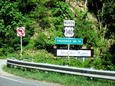
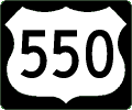 Finally, some new photos: 21 of them, from my May 2008 trip to
southwestern and south-central Colorado. US 550 is noted because
I have several photos of the route's northern endpoint in Montrose,
Colorado. Also featured are US 50, US 160, and US 285.
Finally, some new photos: 21 of them, from my May 2008 trip to
southwestern and south-central Colorado. US 550 is noted because
I have several photos of the route's northern endpoint in Montrose,
Colorado. Also featured are US 50, US 160, and US 285.
- Northern end of US 550 at US 50 in Montrose, Colorado (from northbound US 550)
- Overhead signs for the US 50-US 285 intersection in Poncha Springs, Colorado
- US 550 at US 50 in Montrose, Colorado (from eastbound Colorado 90)
- Northern end of US 550 at US 50 in Montrose, Colorado (from westbound US 50)
- Colorado welcome sign on US 84
- Intersection of US 160 and US 550 in Durango, Colorado
- Illuminated no-right-turn sign on US 550 in Durango, Colorado
- US 285 with state and county routes in Saguache County, Colorado
- Open range in Colorado
- US 160 as the San Juan Skyway at US 550 in Durango, Colorado
- Symbolic sheep warning sign on US 50 in Colorado
- Square US 160 and US 550 markers in downtown Durango, Colorado
- US 160, US 285, and Colorado 17 trailblazer in Alamosa
- US 160 trailblazer on US 550 in Durango, Colorado
- US 160 in Pagosa Springs, Colorado
- US 160 and US 285 at paired one-way streets in Alamosa, Colorado
- US 50 and US 285 in Poncha Springs, Colorado (from US 50)
- US 50 and US 285 in Poncha Springs, Colorado (with square US 285 marker)
- US 50 and US 285 in Poncha Springs, Colorado (from US 285)
- US 550, Colorado 90, and US 50 on Townsend Avenue signal mast in Montrose
- US 50 and US 285 trailblazer in Salida, Colorado
In addition, I was able to move all the photo files back to my main web server. My ISP recently upgraded the server. As part of that upgrade, my quota of disk space more than doubled. So I could bring the photo files back on this server again. If you find any photos or files missing, please let me know.
August 8, 2008
Rearchitected the entire Signs & Sights family of sites. All URLs changed and are now shorter. The easy way to convert any given URL: remove /road/sign from the old URL to get the new URL.June 29, 2007
The JPEGs on the individual sign pages were moved, to be served from another site. I also added links to the new and improved New Mexico Signs & Sights Gallery, which I brought back to the 'Monitor on this date. The New Mexico photos that were formerly at the US Highways Signs and Sights Gallery were moved to the New Mexico site. The indexing and search programs at the US site still list those photos as well as Missouri and California photos in the site galleries for those states.October 18, 2007
Thanks to David Backlin for some contractor goofs and other odd signs in the vicinity of Flippin, Arkansas, where a bypass for US 62 opened this month.August 6, 2007
Added 26 photos, and a new state, thanks to photos David Backlin contributed from a trip to Nebraska, Wyoming, and Colorado in July 2007. One of the photos, on the Colorado-Nebraska border, is taken from nearly the exact spot that my aunt photographed 59 years earlier on what was then US 24. I've updated the page with that photo:Here are the other 25 new photos. Thanks, David!
- Single business-route banner for US 30 and Business Loop 80 near Pine Bluffs, Wyoming
- Bypass US 183 in Hays, Kansas
- US 138 at US 6 at US 138's western endpoint in Sterling, Colorado
- US 81 and Interstate 235 exits from Interstate 135 in Wichita, Kansas
- US 24, US 385, and Interstate 70 in Burlington, Colorado
- Erroneous trailblazer for US 138 at its western endpoint at US 6 in Sterling, Colorado
- Junction sign for US 30 at the eastern endpoint of US 138 in Nebraska
- Plain marker for the Lincoln Highway on US 30 in Nebraska just east of the Wyoming border
- US 85 and Business US 87, along with Business Loop 25 and Interstate 180 in Cheyenne, Wyoming
- Overhead signs for US 6 and Interstate 76 at the western endpoint of US 138 in Colorado
- Smaller-sized marker for Interstate 25 along US 85 and Business US 87 in Cheyenne, Wyoming
- Smaller-size Interstate marker for Interstate 80 along with US 30 in Cheyenne, Wyoming
- Smaller-size markers for Business US 30 and Business Loop 80 in Cheyenne, Wyoming
- Smaller-sized markers for Business Loop 80 and US 30 in Cheyenne, Wyoming
- Smaller-size markers for Business Loop 25 and Interstate 180 along with US 85 and Business US 87 in Cheyenne, Wyoming
- Smaller-size markers for Business Loop 25, US 85, and Business US 87 in Cheyenne, Wyoming
- US 24, Interstate 70, and Kansas 267 at Kanorado, Kansas
- Historic tour routes for US 138 in Nebraska
- US 138 junction with US 6 at US 138's western endpoint in Sterling, Colorado
- US 24 joins Interstate 70 in Burlington, Colorado
- Trailblazer to Interstate 80 from US 30 in Nebraska near the Wyoming state line
- Destination sign for US 138 and Interstate 80 from US 30 in Nebraska
- US 385 in Holyoke, Colorado
- US 54 and US 400 shields of different sizes on Interstate 135 in Wichita, Kansas
- US 138 near its eastern endpoint with trailblazer for Interstate 80 in Big Springs, Nebraska
July 12, 2007
Relocated six photos from the Other Signs and Sights Gallery that I took in Iowa and New Mexico several years ago. This move was in preparation for some other changes that occurred later this summer. (The New Mexico signs were moved to a new New Mexico Road Signs and Sights Gallery in June 2008.)April 4, 2007
Added 20 photos from David Backlin, taken mostly in March, in Arkansas, Louisiana, Oklahoma, and Mississippi. Thanks, David!- US 425 at Arkansas 81 southeast of Pine Bluff
- Markers replacing guide signs lost to Hurricane Katrina on US 49 and US 98 in Hattiesburg, Mississippi
- US 62 at Oklahoma 51, showing Oklahoma state-outline marker, in Eldon
- US 51 goof for Oklahoma 51 at former route of US 59 in Stilwell (2007)
- Louisiana 1 at Interstate 49 in Alexandria
- Junction of Arkansas 81 and US 425 southeast of Pine Bluff
- Junction of Interstate 40 and US 65 south of Conway, Arkansas
- Federal Aid Program marker on US 190 in Livonia, Louisiana
- US 11 and Mississippi 13 intersection in Lumberton
- US 11 and Mississippi 26 in Poplarville
- US 167 and Interstate 49 at US 71 near Alexandria, Louisiana
- Overhead four-way stop signs in Poplarville, Mississippi
- Scenic Oklahoma 10 with state-outline shield near Tahlequah
- Red and yellow diamond warning sign in Lumberton, Mississippi
- Series B font on US 80 marker at US 65 In Tallulah, Louisiana
- Older-style trailblazer for US 190 near Port Allen, Louisiana
- US 190 and the Acadiana Trail in Louisiana
- Business US 165 at US 71 and US 165 in Alexandria, Louisiana
- US 98 marker replacing guide sign lost to Hurricane Katrina on US 49 south of Hattiesburg, Mississippi
- US 11 reassurance marker that's actually not on US 11 in Poplarville, Mississippi
January 20, 2007
Added 10 photos from David Backlin from trips in Oklahoma during 2004. These had been in my archives for some time when I discovered them recently. Thanks, David, for the contributions!- Button reflectors for Interstate 44 and Oklahoma 66 to Joplin, Missouri
- Memorial to President Kennedy on US 259 in southeastern Oklahoma
- Big Cedar Overlook and memorial to President Kennedy on US 259 in Oklahoma
- Bypass US 59 shown as US 59 and US 271 near Poteau, Oklahoma
- Button reflectors for a US 412 exit sign from US 69 south of Chouteau, Oklahoma
- US 59 and US 271 at Bypass US 59 near Poteau, Oklahoma
- Interstate 35, US 64, and US 412 at the Cimarron Turnpike in Oklahoma
- Button reflectors and a standalone-style marker for US 75 in Oklahoma
- Distorted font on Interstate 244 and US 412 in Tulsa, Oklahoma
- Button reflectors for Interstate 44 and Oklahoma 66 in Tulsa
Also revised this page regarding odd US 14 shields photographed in the Chicago area in 1998. One of the shields, on Broadway in the Edgewater neighborhood, has since been replaced.
Finally, the "version 7" page of links was removed from the site, in hopes of making maintenance less burdensome and allowing me more time to work on content.
November 26, 2006
Added 35 photos (on 34 pages) from a Labor Day weekend trip to Portland, Oregon, adding another state of the roster of states covered at the site. Also featured in this set are photos of notable sites along the Historic Columbia River Highway.- Streetcar track warning for bicycles in Portland, Oregon
- Bridal Veil falls east of Portland, Oregon (closer view)
- Bridal Veil falls east of Portland, Oregon (full-height view)
- Bridge of the Gods over the Columbia River
- Burnside Bridge in Portland, Oregon
- Bypass US 30 in Portland, Oregon (close-up)
- Bypass US 30 at Columbia Boulevard in Portland, Oregon
- Columbia River in Oregon, viewed from Crown Point
- Crown Point along the Historic Columbia River Highway, viewed from the Women's Forum vista point
- Crown Point along the Historic Columbia River Highway, viewed from US 30/Interstate 84
- Crown Point Vista House along the Historic Columbia River Highway east of Portland, Oregon
- End of the Oregon Trail
- Kansas City engineering of the Hawthorne Bridge in Portland, Oregon
- Oregon speed sign at the Hawthorne Bridge in downtown Portland
- Hawthorne Bridge in Portland, Oregon
- Historic Columbia River Highway in Oregon
- Horsetail Falls along the Historic Columbia River Highway in Oregon
- Interstate 405 and US 30 from Interstate 5 in Portland, Oregon
- US 30 and Interstate 84 from Crown Point in Oregon
- US 30 and Interstate 84 as seen from the Women's Forum vista point in Oregon
- US 30 and Interstate 84 to the Portland airport from Interstate 5 in Oregon
- Morrison Bridge in Portland, Oregon (east end)
- Morrison Bridge in Portland, Oregon
- US 26 at Interstate 5 south of downtown Portland, Oregon
- Two-way advisory sign in downtown Portland, Oregon
- Union Station in Portland, Oregon
- Tribute to the chief engineer for the Columbia River Highway in Oregon
- Bridges over the Willamette River in downtown Portland, Oregon
- Drawbridge towers of the Steel Bridge in Portland, Oregon
- Multiple methods of transportation on the Steel Bridge in Portland, Oregon
- Warning sign on the Hawthorne Bridge in Portland, Oregon
- Bypass US 30 from Interstate 84 in Portland, Oregon
- Vista House on the Historic Columbia River Highway (ceiling)
- Vista House on the Historic Columbia River Highway (interior)
November 14, 2006
Here are two more contributions from David Backlin, also showing the 2006-style Oklahoma "meat cleaver" state route marker. Thanks again, David!November 13, 2006
Added 28 photos (on 26 pages) from David Backlin, taken on a trip through Kansas and Colorado in July. Thanks, David!- US 24 and Business Loop 70 at Interstate 70 in Limon, Colorado (advance sign)
- US 24, US 40, US 287, and Business Loop 70 with a trailblazer to Colorado 71 at Interstate 70 in Limon
- Blue ramp marker on US 54 leading to Interstate 135 in Wichita, Kansas
- Advance exit sign for Business US 81 in McPherson, Kansas
- Junction of US 24 at US 385 in Burlington, Colorado
- Junction of US 40 and US 287 at Colorado 94 near Aroya
- US 81 and Interstate 135 at Kansas 140 in Salina
- US 24, US 40, US 287, and Interstate 70 in Limon, Colorado
- US 24, US 40, US 287, Business Loop 70, and Colorado 71 in Limon
- US 24, US 40, and US 287 in Limon, Colorado
- North Business US 81 and South Kansas 61 in McPherson
- Trailblazers to US 81 and Interstate 135 in Salina, Kansas
- Junction of US 166 in South Haven, Kansas
- US 81 and US 177 intersect in South Haven, Kansas
- US 177 ends at US 81 in South Haven, Kansas
- US 166 at US 81 in South Haven, Kansas
- US 166 and US 177 end at US 81 in South Haven, Kansas
- Business US 24 exit from US 24 in Manitou Springs, Colorado
- US 24 interchange with Interstate 25 in Colorado Springs, Colorado
- Destination sign for US 24 in Manitou Springs, Colorado
- US 40 and 287 at the eastern endpoint of Colorado 94 near Aroya
- US 40 and US 287 advance sign on Interstate 70 in Limon, Colorado
- US 50, Interstate 135, and Kansas 15 in Newton, Kansas
- US 81 at the Interstate 135-Interstate 235 interchange north of Wichita, Kansas
- Business US 40 at US 283 in Wakeeney, Kansas
- US 81 and US 160 in Wellington, Kansas
October 1, 2006
I removed all the direct e-mail links from the pages that had those links. This was an attempt to reduce a particularly difficult type of spam that has begun showing up at my e-mail provider. A new e-mail address is provided on a separate Contact Information page.July 4, 2006
More photos from David Backlin showing the new "meat cleaver" marker style for Oklahoma state routes, plus a couple of photos from Mississippi and one from Arkansas. Thanks, David!- US 64 and Oklahoma 64B showing the 2006 marker style in Oklahoma
- Old and new-style Oklahoma markers in Arkoma
- New-style (2006) Oklahoma marker on a big green sign on US 64
- Oklahoma 64D with the 2006 marker style
- US 11 (unsigned) at US 98 and Interstate 59 in Hattiesburg, Mississippi (north side of interchange)
- US 11 (unsigned) at US 98 and Interstate 59 in Hattiesburg, Mississippi (south side of interchange) with US 49 trailblazer
- US 59 at Oklahoma 10 and Oklahoma 20
- US 65 and US 165 along with scenic byway designations in Arkansas
Also in Arkansas, thanks to H.B. Elkins for these photos from northeastern Arkansas in 2001 (and apologies for taking so long!)
June 21, 2006
Starting with the beginning of Historic US 66 in Chicago, courtesy of an anonymous contributor:Also: more contributions from David Backlin from Oklahoma and Tennessee. Thanks again, David!
- Three Way, Tennessee, where US 45 splits into US 45W and US 45E
- Tipton County, Tennessee and Isaac Hayes
- Trailblazer to distant Will Rogers Turnpike from Indian Nation Turnpike in Oklahoma
- Branching off on US 45 north of Jackson, Tennessee
- US 45W intersects with US 79 in Humboldt, Tennessee
- New-style (2006) Oklahoma marker on a big green sign along US 62
- Vintage red flashing traffic light in Humboldt, Tennessee
- Vintage yellow flashing traffic light in Humboldt, Tennessee
June 14, 2006
Contributions from David Backlin of photos in Oklahoma and Tennessee, including the new so-called "meat cleaver" Oklahoma state markers. Thanks, David! This update was delayed because programming changes were required in order to handle suffixed US routes.- Tennessee 79 goof for US 79 at US 70 in Arlington
- Business US 45W at Bypass US 79 in Humboldt, Tennessee
- Bypass US 45 from US 45 to US 70 in Jackson, Tennessee
- Bypass US 79 and US 70A in Humboldt, Tennessee
- End of US70A at US 70 along US 79 in Brownsville, Tennessee
- End of US 70A at US 70 along US 79 in Brownsville, Tennessee (with Interstate 40 trailblazer)
- US 45W, US 70A, and US 79 in Humboldt, Tennessee
- US 271 at Oklahoma 3 with 2006-style state marker, and Indian Nation Turnpike trailblazer
- Former junction of Bypass US 45W in Humboldt, Tennessee
- Junction of Bypass US 79 and US 70A at US 79 and US 70A in Humboldt, Tennessee
- US 45 splits into US 45E and US 45W in Tennessee
- Junction of US 70A and US 79 at US 45W in Humboldt, Tennessee
- Indian Nation Turnpike reassurance marker in Oklahoma
- US 271 and Oklahoma 109 with new-style (2006) state route marker
- US 45W (should be Business US 45W) in Humboldt, Tennessee
- US 271 and Oklahoma 271A with new-style (2006) state route marker
- Business US 45W at US 45W, US 70A, and US 79 in Humboldt, Tennessee
- Tennessee-style arrow for US 45W in Humboldt
- South and north US 45W in Humboldt, Tennessee
- New-style Oklahoma marker on a BGS along US 62 in Muskogee
May 25, 2006
A design facelift for the entire site! The biggest changes were at the Missouri, California, and US Highways Signs and Sights Galleries, where the top-level index page was replaced by a search page, enabling you to quickly find photos for specific routes, types of routes, or categories of photos. You can also search for photos relating to specific states.Other than the new search pages, the most notable changes seen by most users are the new fonts used across the entire site. (This was before third-party web fonts were widely used.) The new design should also look a little bit better with Internet Explorer 6 than the old design.
April 1, 2006
Thanks again to David Backlin, who found this confusing sign on US 49 as it approaches Interstate 20 in Jackson, Mississippi.March 29, 2006
Added an index by photo category to the other category indexes.March 27, 2006
Thanks to David Backlin, who contributed two photos taken along US 65 in northeastern Louisiana earlier in the month.February 5, 2006
Added a photo of a goof on US 271 in Oklahoma near the Arkansas border. Thanks to David Backlin for this catch!January 29, 2006
Moved 56 pages with 61 photos from this gallery to the Missouri Road Signs and Sights Gallery. The move was made to consolidate all the Missouri photos into the Missouri gallery. The Recent Additions page at the Missouri Road Signs and Sights Gallery lists the pages that were moved.January 21, 2006
Added a picture of a square US marker, unusual in Illinois, taken by Joe Reda in 2005. Thanks, Joe!December 30, 2005
Added a page listing all US Highways photos at this site (in all galleries), alphabetized by the descriptive text in the link. Anchors are included for each letter of the alphabet. For example, adding "#E" to the URL will take you directly to the links beginning with the letter E. Also fixed a logic error that prevented a few pages in the US Highways gallery from being indexed correctly.December 20, 2005
Added eight new photos (on seven pages) taken by David Backlin in Arkansas and Texas. Thanks, David!December 13, 2005
Added anchors within the indexes by category. I hope to make more use of this feature in the future. In the meantime, you can use them to move around more quickly in each of the indexes. For example, when in the Route Index, type "#US71" after the URL to find the listings for US 71. When in the State Index, type "#Oklahoma" after the URL to find the listings for Oklahoma. Be sure to omit any spaces and punctuation marks (examples: US395, NewMexico). In the Route Index, use "BR" for Business Routes and "SP" for Spur Routes.December 5, 2005
Added programs that create page and photo counts of the cities, routes, and states shown in this and the other Signs and Sights Galleries, as well as counting the categories of photos shown and the number of contributors.December 4, 2005
Moved eight pages (with nine photos) from this gallery to the California Road Signs and Sights Gallery. Two pages (with two photos) that duplicated photos at the California gallery were removed. The pages that were moved are listed on the Recent Additions page at the California gallery.November 18, 2005
Added three photos from David Backlin, taken in Louisiana in November 2005. Thanks again, David!November 17, 2005
Added 11 photos taken during my September 2005 trip to Missouri. Many more are at the Missouri Signs and Sights Gallery.- Business US 50 in Jefferson City, Missouri
- Business US 54 exit from US 54 near Eldon, Missouri
- Business US 54 and Missouri 52 exit from US 54 near Eldon, Missouri
- Business US 54 and Missouri 52 south of Eldon, Missouri
- Blue arrows for Interstate 29 and US 71 in Platte Woods, Missouri
- Junction of Business US 65 and US 65 in Trenton, Missouri
- Destination sign for Interstate 29, US 71, and Interstate 435 in Kansas City, Missouri (airport)
- Pointing to Interstate 29 and US 71 at the end of Missouri 9 in Kansas City
- US 136 and US 65 concurrence in Princeton, Missouri
- US 54 and US 63 from Missouri 94 in Jefferson City
- US 65 and US 136 in Princeton, Missouri
Also added 18 photos taken by David Backlin in 2004 and 2005. Thanks once again, David!
- Eastern endpoint of US 160 in Poplar Bluff, Missouri (westbound direction)
- Business US 60 plus US 61 and US 62 near Sikeston, Missouri
- Approaching endpoint of Interstate 57 on US 60 in Missouri
- Eastern endpoint of US 160 in Poplar Bluff, Missouri (eastbound direction)
- Business US 67 near Fredericktown, Missouri
- US 62 instead of US 63 at US 412 junction in Imboden, Arkansas
- Button reflectors for US 75 in Jenks, Oklahoma
- Business US 67 and US 160 with Missouri 53 trailblazer in Poplar Bluff, Missouri
- US 65 and US 425 in Pine Bluff, Arkansas
- US 425 in Pine Bluff, Arkansas
- US 60 and US 62 in Cairo, Illinois
- Junction of US 60 and US 67 in Poplar Bluff, Missouri
- US 61, US 62, and Business Loop 55 in New Madrid, Missouri
- US 61 and US 62 south of Howardville, Missouri
- US 62 and US 61 intersect south of Howardville, Missouri
- US 62, US 63, and US 412 in Imboden, Arkansas
- US 60, US 67, and Business US 67 interchange at Poplar Bluff, Missouri
- US 62 joins US 63 and US 412 at Imboden, Arkansas
August 28, 2005
Added indexes by category. These indexes list pages at all the sign galleries, not just the US Highways gallery. These indexes were made possible by the huge XHTML conversion earlier this year. They are a first step toward a new approach toward managing the galleries that I hope to unveil in the coming months. The new indexes are:August 14, 2005
Added two photos taken by David Backlin this month in southern Missouri. Also see the Missouri Highways Signs & Sights Gallery for more contributions from David. Thanks, David!July 19, 2005
Added a photo of an especially nice example of the use of button reflectors in California, a trailblazer at a freeway entrance for US 101 in Arroyo Grande. I took the photo in November 2004. The sign was still there in July 2005. I migrated the sign to the California Road Signs and Sights Gallery on December 4, 2005.- US 101 freeway entrance trailblazer in Arroyo Grande, California (button reflectors)
March 31, 2005
Converted all the pages (except the legacy index page) to XHTML 1.1. Added contributions from David Backlin. Thanks again, David! Arkansas and Louisiana photos were taken in October 2004.- Endpoint of US 34 in Lyons, Illinois
- Endpoint of US 34 at Illinois 43 in Lyons, Illinois
- Two Historic US 66 routes near Staunton, Illinois
- Junction of US 371 in Dixie Inn, Louisiana
- National Road historic marker in Illinois
- US 59 and US 270 north of Mena, Arkansas
- US 71 and US 270 north of Mena, Arkansas
- US 71, US 67, and US 82 in Texarkana, Arkansas
- Single US 79-80 shield in Shreveport, Louisiana
- US 79 and US 80 on two shields in Minden, Louisiana
- US 79 and US 80 split at Minden, Louisiana
- US 79 and US 80 with US 371 trailblazer in Minden, Louisiana
- Truck routes for US 79 and US 80 in Minden, Louisiana
Plus a couple more photos from my archives, taken in 1998.
Renamed files
Renamed some older files (especially from Illinois in 1998) to fit with the newer naming scheme.- US 6 at Illinois 34 and 40
- US 14 as the Ronald Reagan Highway
- US 24 in downtown Quincy, Illinois
- US 24 cutout in Kansas (1948)
- US 45 and 52 at Illinois 49
- Bypass US 54 at Tucumcari, New Mexico
- End of US 54 north of Pittsfield, Illinois
- US 136 at Illinois 100 west of Havana, Illinois
- A wide-style Missouri three-digit shield, rare until 2000
- US 136 and US 218 in Keokuk, Iowa
- Covered-up US 67 in Jacksonville, Illinois (1998)
- US 14 in Chicago and Niles, Illinois (two locations) (1998)
- Misleading exit for US 14 off Chicago's Lake Shore Drive
- Not a mistake but confusing: East US 24 and West US 136 west of Havana, Illinois
October 18, 2004
Added two photos from my trip to upper northern California in September 2004 (since migrated to the California Signs and Sights Gallery on December 4, 2005), plus new text regarding the Texas business-route shields with "BUSINESS" within the shield. It was a former Texas standard, superseded by October 2004. Thanks to Jonathan Winkler for his discussion of the topic in misc.transport.road.- Historic US 99 in California (Red Bluff and Yreka)
- US 97 in Weed, California (button reflectors)
- New text: Business US 87 in Dalhart, Texas
- New text: Business US 271 and US 82 in Paris, Texas
August 24, 2004
Contributions from David Backlin during the spring and summer of 2004.- Business US 65 in Springfield, Missouri
- Business US 71 in Butler, Missouri
- Historic US 66, Bourbon, Missouri
- "Doghouse" traffic sign on Business US 70, Hugo, Oklahoma
- Historic US 66, Manchester, Missouri
- Button-copy mileage sign, Paris, Texas
- "Old Highway 66", Bourbon, Missouri
- Business US 67 in Sulphur Springs, Texas
- Tiny sticker for Historic US 66, St. Clair, Missouri
- Business US 71 near Joplin, Missouri
- Missouri 96 and Historic US 66 near Halltown, Missouri
- US 63 and Business Loop 44 at Interstate 44, Rolla, Missouri
- US 70 and Bypass US 70, Hugo, Oklahoma
- US 71 entrance ramp, Belton, Missouri
- Blue US 78 shield in Alabama
- Business US 271 and US 82 in Paris, Texas
Renamed files
Renamed a couple of files from Dalhart, Texas in January 2000 to fit with the newer naming scheme.June 5, 2004
From my May 2004 trip to New Mexico.- Historic US 66 district in Albuquerque
- US 66 as Business Loop 40 in Albuquerque
- Historic US 66 near Santa Fé
- Pre-1937 Historic US 66 in Albuquerque
- Where two historic US 66 routes meet in Albuquerque
- Business Loop US 64, Farmington, New Mexico
- End of US 64 in Arizona near the Four Corners
- Color US 54 green in Alamogordo, New Mexico
- US 550 near Cuba, New Mexico
- US 54 and US 70 in one shield at Tularosa, New Mexico
- US 54, 70, and 82 in Alamogordo, New Mexico (But it's not US 82 any more)
- US 550 and US 64 with arrows in color
- Normal US 60, big US 285, and NM 3 in Encino, New Mexico
- Vaughn, New Mexico: US 60, 54, and 285 | Also: Where routes divide
- Odd font: US 60 at Socorro, New Mexico
- Continental Divide on US 550 in New Mexico: Highway marker | Scenic marker | Warning marker
- US 380 in south-central New Mexico: Square sign, narrow font | Square sign, wide font | Wide sign, small font
March 11, 2004
Contributed by Mike Dietrich. Contributed by David Backlin. Finally, one more from my October 2003 trip to Missouri.February 15, 2004
Contributed by David Backlin.- Business US 71 in Anderson, Missouri
- Bypass US 59 in Poteau, Oklahoma
- Cherokee yield sign (in Tahlequah, Oklahoma)
- US 69A in Oklahoma
- US 166 and US 400 at Kansas 26
- "Oklahoma" 59 and 271
- Alternate US 69 in Oklahoma (revised with additional photo)
- Business US 60 in Oklahoma near Seneca, Missouri (cutout sign)
- Same route, slightly different designation: US "60B" near Seneca, Missouri
- Pointing to the Will Rogers Turnpike
- Another pointer to the Will Rogers Turnpike
- US 70 near Roswell, New Mexico
- Scenic US 412 in Oklahoma (revised with additional photo)
- US 380 in Roswell, New Mexico
- US 412 near Tulsa, Oklahoma
- Misleading Interstate 40 sign in Vian, Oklahoma
- US 60 and 160 in Springfield, Missouri
February 3, 2004
From my October 2003 trip to Missouri. Most of the photos from that trip are at the Missouri Road Signs and Sights Gallery.- Business US 36 in Hamilton, Missouri (old button copy)
- US 169 freeway mileage markers in Kansas City, Missouri
- US 169 in Kansas City, Missouri (freeway style)
August 26, 2003
Contributed by Scott Maness (US 66) and David Backlin (Pittsburg, Kansas signs).- US 66 revived in Joplin, Missouri (late 1990s construction marker)
- Wide and square US and Kansas styles: US 69, US 400, US 160, and Kansas 103 near Pittsburg
Earlier Updates
(Not a complete list)
July 17, 2003: Added photos from my May 2003 trip to Lake Tahoe and the US 395 corridor in California. More photos from this trip are at the California Road Signs & Sights Gallery.
June 8, 2003: Added US 54 pictures in west-central Missouri from my March 2003 trip to Missouri. More photos from this trip are at the Missouri Road Signs & Sights Gallery.
December 27, 2002: Added US 66 exit-sign photo along the Will Rogers Turnpike. Thanks to Ben Prusia!
October 13, 2002: Added "Business" US 63 and Jefferson City US 50/54/63 photos from my September 2002 trip to Missouri, and added 26 photos from David Backlin's road trip to Missouri and Iowa (thanks, David!). More photos from these trips are at the Missouri Road Signs & Sights Gallery.
Denver, Colorado
E-mail: Please see the Contact Information page.