Welcome to the Missouri Road Sign and Sights Gallery! This page lists the most recent additions and changes that have been made.
November 9, 2024
Some additional cleanup, including reducing the presence of the Missouri Route Log, which is now more than a decade out of date. Also replaced links to my former Twitter feed with links to my Mastodon feed.October 28, 2024
After a long period of inattention, it's time to start considering the future of this site. The first task is to clean up some longstanding issues and problems. I also plan to remove the Missouri Route Log at a future date because it hasn't been updated for years. I also want to make the site more manageable. Achieving all these objectives will take some time.March 8, 2020
Updates have been infrequent in recent years. The Route Log, in particular, may now have some information that's out of date. Site features remained available as a service.December 3, 2017
Yes, there's a lot of backlog. I added a link to a page about the future of this site and related sites (since removed).December 30, 2014
In the program to query by city or county, I found a longstanding bug that would cause queries with strange capitalization, or in all-caps, to fail. This has been fixed, and you can now use any kind of capitalization you want.August 11, 2014
A spot check found that I never actually updated this page on March 30, though I had updated the design! Never mind; that way, you didn't have to deal with the broken link to the colophon on this page. In addition, I made minor changes to the text on this page to resolve anachronisms that crept in over time.March 30, 2014
New site design! After more than five years with the same design, the site began to look dated. The new design is an evolution from the 2008 version. The biggest change is the use of Google Fonts for the pages. See the colophon for more details about the fonts. For those of you interested in radio, I also recovered articles about my radios from blogging sites that I had used but which either shut down or had other problems.April 7, 2013
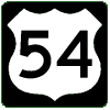 The Route Log was updated to add the Business US 54 designation
in Osage Beach. MoDOT announced on April 3 that it will be marking
the Osage Beach Parkway at Business Route 54. According to MoDOT,
"The name change and the signs are meant to help motorists more
readily recognize the parkway as the Osage Beach business district."
Hat tip to David Backlin for the information.
The Route Log was updated to add the Business US 54 designation
in Osage Beach. MoDOT announced on April 3 that it will be marking
the Osage Beach Parkway at Business Route 54. According to MoDOT,
"The name change and the signs are meant to help motorists more
readily recognize the parkway as the Osage Beach business district."
Hat tip to David Backlin for the information.
March 4, 2013
It was time for the annual note, more or less, marking this site's founding on March 4, 1998. Due to an extremely hectic work and personal schedule at the moment, I wasn't able to do something special for the 15th anniversary in 2013 -- or the 16th anniversary in 2014. Thanks for your interest over these many years!January 26, 2013
 Added 24 more photos from my September 2012 trip to Missouri, this time
focusing on northern and central Missouri, including driving the entire
length of Missouri 107, also known as "clinching" the route, as well
as revisiting Crowder State Park and finding a couple of mixed-case
city-limit signs.
Added 24 more photos from my September 2012 trip to Missouri, this time
focusing on northern and central Missouri, including driving the entire
length of Missouri 107, also known as "clinching" the route, as well
as revisiting Crowder State Park and finding a couple of mixed-case
city-limit signs.
I also rescanned three photos from 1998 and 2002 to provide larger images and to provide a "now and then" comparison of the Missouri 128 reassurance marker at Crowder State Park as well as the Paris city-limit sign on Missouri 15 at the southern city limits.
- Boone County maintenance sign
- Business US 24 and Missouri 154 in Paris
- Clearview font on street signs in Columbia
- End of Missouri 107 east of Stoutsville (northern terminus)
- End of Missouri 107 east of Paris (southern terminus)
- MoDOT maintenance sign at the end of Missouri 128 in Crowder State Park (beginning of state maintenance)
- End of pavement stripe at the end of Missouri 128
- MoDOT maintenance sign at the end of Missouri 128 in Crowder State Park (end of state maintenance)
- End of Missouri 146 (2012)
- Speed-limit signs with extra wrapper in Columbia
- Madison city limits (mixed-case)
- Missouri 116 on destination sign along Interstate 35 in Clinton County
- Missouri 116 exit from Interstate 35 in Clinton County
- Missouri 128 to Crowder State Park near Trenton (2012)
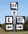
- Missouri 154, Missouri 107, and Route E in Monroe County
- Missouri 190 at Missouri 146 in Grundy County
- Misleading destination sign at the northern end of Missouri 107
- Missouri 151 and US 24 in Paris
- Paris city limits (2012)
- End of Business US 24 and Missouri 154 in Paris
- US 24 and Missouri 151 at the start of a brief concurrence in Paris
- US 69 at Missouri 6 with Interstate 35 trailblazers west of Altamont
- US 69 at Missouri 6, with Missouri 6 going to Trenton
- Winston city limits (mixed-case)
Here are the rescanned photos:
January 13, 2013
 Added 17 photos from the Kansas City stay during my September 2012
vacation to Missouri, including a leftover exit sign for Missouri 269
(left), which was decommissioned earlier in 2012. I also rescanned
my 1998 picture of the southern endpoint (terminus) of Interstate 29.
The sign has since been replaced, with the signed endpoint moving to
a different location -- actually, two locations.
Added 17 photos from the Kansas City stay during my September 2012
vacation to Missouri, including a leftover exit sign for Missouri 269
(left), which was decommissioned earlier in 2012. I also rescanned
my 1998 picture of the southern endpoint (terminus) of Interstate 29.
The sign has since been replaced, with the signed endpoint moving to
a different location -- actually, two locations.
- Riverbank view of the Bond Bridge in Kansas City
- Curve approaching south end of the Christopher Bond Bridge in Kansas City
- Christopher Bond Bridge in Kansas City, southern approach
- Broadway Bridge in Kansas City as seen from Broadway with 6th Street Trafficway sign downtown
- End of Interstate 29 at the northeast corner of the Kansas City downtown freeway loop (2012)
- End of Interstate 29 just south of the Paseo Bridge in Kansas City (1998) (rescanned photo and revised text)
- End of Missouri 9 on Heart of America Bridge in Kansas City
- First Missouri exit on Interstate 35 northbound in Kansas City
- Westbound Interstate 70 on the downtown Kansas City freeway loop
- Bartle Hall in the background on Broadway in Kansas City
- Big blue sign with tourist attractions with an addition in Kansas City
- Big blue sign with tourist attractions in Kansas City
- Exit sign for non-existent Missouri 269 from Missouri 210 in North Kansas City (2012)
- Exits in the northeast corner of the Kansas City downtown freeway loop
- Missouri 9, US 24, and Interstates 35 and 70 in downtown Kansas City
- Single-panel trailblazer for US 24, Interstate 35, and Interstate 70 on Independence Avenue in downtown Kansas City
- All directions at US 169 and Interstate 70 in downtown Kansas City from West 5th Street
Because of the replacement of the Paseo Bridge with the Christopher Bond Bridge, as well as the decommissioning of Missouri 269, I also revised the pages referring to either of them.
- End of Missouri 269 in Kansas City (1998)
- Missouri 210 and Missouri 269 in North Kansas City (2008)
- End of Missouri 269 (northern endpoint)
- Paseo Boulevard just south of the Paseo Bridge in Kansas City (1998)
- Paseo Boulevard just south of the Paseo Bridge in Kansas City (2006)
- US 269 goof for Missouri 269 in Kansas City
- West and East Missouri 210 in North Kansas City
January 8, 2013
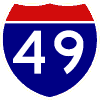
 Updated Route Log entries (and the
Route Log PDF) for Interstate 49,
Business Loop 49, US 71, and Business US 71 as a consequence of I-49's
official opening on December 12, 2012. Also added Spur MO 215 in Polk
County near Brighton. Thanks to David Backlin for the tip on Spur
Route 215.
Updated Route Log entries (and the
Route Log PDF) for Interstate 49,
Business Loop 49, US 71, and Business US 71 as a consequence of I-49's
official opening on December 12, 2012. Also added Spur MO 215 in Polk
County near Brighton. Thanks to David Backlin for the tip on Spur
Route 215.
Also note that the PDF now uses OpenSans, an open-source font from Google Web Fonts. Expect to see more of this font at the site in future updates.
January 5, 2013
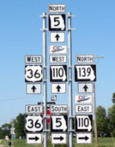 Added seven photos from my trip to Missouri in September 2012, taking care
to swing by north Missouri after the Missouri 110 designation (the
Chicago-Kansas City Corridor) was added to US 36 between Cameron and
Hannibal earlier in the year. Especially in Linn County, some big sign
assemblies resulted. Some call them "sine salads"; I like to call them
"sign stacks" because they just stack one sign atop other signs.
Added seven photos from my trip to Missouri in September 2012, taking care
to swing by north Missouri after the Missouri 110 designation (the
Chicago-Kansas City Corridor) was added to US 36 between Cameron and
Hannibal earlier in the year. Especially in Linn County, some big sign
assemblies resulted. Some call them "sine salads"; I like to call them
"sign stacks" because they just stack one sign atop other signs.
For more on Missouri 110, check out the contributions from Matt Roberds that I posted in April and August 2012.
- Missouri 5, 110, 139 and US 36 seven-marker assembly in Laclede
- Northbound Missouri 11 at US 36, Missouri 5, and Missouri 110 in Brookfield
- US 36, Missouri 5, and Missouri 110 on Missouri 11 at the Brookfield interchange of US 36
- Missouri 5, US 36, and Missouri 139 at Missouri 130 in Linn County
- Truck detour for Missouri 139 along US 36 and Missouri 110 east of Chillicothe (2012)
- Pointy-style marker for Missouri 129 at US 36 and Missouri 110 in Macon County
- Side-mounted Missouri 110 marker on larger destination sign for US 36 and Missouri 5 at Missouri 11 in Brookfield (2012)
There will be more photos from my Missouri trip in future updates.
January 3, 2013
 Three contributors have generously provided 34 photos of Interstate 49
on its first official day in Missouri, December 12, 2012. From the
Grandview Triangle (I-470 and I-435) in Kansas City, to Pineville, a few
miles north of the Arkansas border, the Interstate 49 designation will
be added to the current route of US 71. The southernmost ten miles of
US 71 in Missouri won't carry the designation. A new route will eventually
be built into Arkansas to provide a bypass around Bentonville.
Three contributors have generously provided 34 photos of Interstate 49
on its first official day in Missouri, December 12, 2012. From the
Grandview Triangle (I-470 and I-435) in Kansas City, to Pineville, a few
miles north of the Arkansas border, the Interstate 49 designation will
be added to the current route of US 71. The southernmost ten miles of
US 71 in Missouri won't carry the designation. A new route will eventually
be built into Arkansas to provide a bypass around Bentonville.
Photos from Matt Roberds, including a work crew turning the new signs to face traffic on the official opening day:
- Business Loop 49 at 32nd Street in Joplin
- Business Loop 49 designation in Joplin (2012)
- Markers for Interstate 44 and Missouri 249 at Interstate 49 and US 71 in Joplin
- All route types at Interstate 49/US 71 and Route FF in Joplin
- Interstate 49/US 71 in Missouri 291 near Harrisonville
- Interstate 49 0.2-mile marker south of Carthage
- Gifts and novelties for the opening day of Interstate 49 in Missouri
- Business Loop 49 exit from Interstate 49/US 71 in Passaic
- No state name on Interstate 49 shields in Joplin (2012)
- Junction Interstate 49 and US 71 at Route FF in Joplin
- Missouri Department of Transportation boundary marker
- Same-day service for Interstate 49 mile markers in Bates County (2012)
- Interstate 49 and US 71 at Missouri 150 in Grandview
- A US 71 sign without Interstate 49 in Jasper County (2012)
Even though Missouri's usual practice has been to put the state name on individual marker signs, that practice wasn't followed for much of Interstate 49. But Chris Knight found an Interstate 49 marker with the state name:
Amid these photos from David Backlin are photos of the temporary southern terminus of Interstate 49 south of Pineville:
- I-44, I-49, and US 71 advance sign on Missouri 59 in Jasper County
- Business Loop 49, Missouri 96, and Missouri 171 in Carthage
- Two business loops intersect in Joplin (2012)
- Destination sign on Missouri 59 showing the I-44/I-49 concurrence
- The end of Business Loop 49 and Missouri 171 without Interstate 49 (2012)
- The end of Business Loop 49 and Missouri 171 in Carthage (2012)
- Southernmost northbound Interstate 49 sign in Missouri (2012)
- Historic US 66 alignments designated in Webb City
- Business Loop 49, Interstate 49, US 71, Missouri 96, and Missouri 171 at the terminus of Missouri 571 in Carthage
- Business Loop 49 and Missouri 175 exit from Interstate 49/US 71 in Newton County
- Interstate 49 mile marker in Pineville
- Interstate 49 and US 71 at Route H in Pineville
- Junction of Interstate 49, US 71, Business Loop 49, and Missouri 171 at the end of Missouri 571 in Carthage
- All route types on Missouri 59 in Goodman
- Different-sized Business Loop 49 markers at Business US 60 in Neosho
- Southern end of Interstate 49 in Missouri (2012)
- Highway curve marking the temporary southern end of Interstate 49 at US 71 (2012)
Many thanks to Chris, David, and Matt for their team coverage (as they'd say on local TV news) of Interstate 49!
In this update, also corrected the Route Log entry for Interstate 49, to reflect the fact that the designation currently does not go all the way to the Arkansas state line.
I also removed links to my Tumblr page, which I stopped maintaining. no longer maintaining. Subsequently, Posterous shut down, and I ceased maintaining a site on Blogger as well (it still exists but I am not updating it).
August 28, 2012
 As the Missouri 110 designation crept gradually into north-central
Missouri during the first half 2012, Matt Roberds took a few photos
of the signs on US 65 at its interchange with US 36 (and Missouri 110)
in Chillicothe. Thanks once again, Matt! The photos are from
June 2012:
As the Missouri 110 designation crept gradually into north-central
Missouri during the first half 2012, Matt Roberds took a few photos
of the signs on US 65 at its interchange with US 36 (and Missouri 110)
in Chillicothe. Thanks once again, Matt! The photos are from
June 2012:
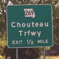
May 27, 2012
 Updated the Route Log and relevant photo pages to reflect the impending
decommissioning of Route 269 in the Clay County portion of Kansas City.
According to a report in the Kansas City Star, the state
will relinquish Route 269 as part of the city's project to replace
the two-lane portion of Chouteau Trafficway south of Interstate 35
with a new Chouteau Parkway. (Reported in the Star on
May 20.) Missouri 269 at one time extended from
US 69 to Interstate 70, going across the Missouri River on the Chouteau Bridge.
In recent years, the route designation has covered only part of
Chouteau Trafficway, from NE 41st Street and Winn Road on the
north, going through the Missouri 210 interchange, terminating at the
north landing of the rebuilt Chouteau Bridge.
Updated the Route Log and relevant photo pages to reflect the impending
decommissioning of Route 269 in the Clay County portion of Kansas City.
According to a report in the Kansas City Star, the state
will relinquish Route 269 as part of the city's project to replace
the two-lane portion of Chouteau Trafficway south of Interstate 35
with a new Chouteau Parkway. (Reported in the Star on
May 20.) Missouri 269 at one time extended from
US 69 to Interstate 70, going across the Missouri River on the Chouteau Bridge.
In recent years, the route designation has covered only part of
Chouteau Trafficway, from NE 41st Street and Winn Road on the
north, going through the Missouri 210 interchange, terminating at the
north landing of the rebuilt Chouteau Bridge.
April 4, 2012
 For the first time in a while, some new photos! Thanks to Matt Roberds
for his photos of Missouri 110 reassurance markers that replaced
Interstate 35 reassurance markers in Cameron and points south. David Backlin
and G.R. Van (Gene Van Dusseldorp) contributed photos of new 0.2-mile
markers on US 71 for the soon-to-be designated Interstate 49 (along with
other photos, too), and Scott Manness contributed a very odd photo
from Arkansas near the Missouri border. Here's the list of 22 photos
(on 21 pages):
For the first time in a while, some new photos! Thanks to Matt Roberds
for his photos of Missouri 110 reassurance markers that replaced
Interstate 35 reassurance markers in Cameron and points south. David Backlin
and G.R. Van (Gene Van Dusseldorp) contributed photos of new 0.2-mile
markers on US 71 for the soon-to-be designated Interstate 49 (along with
other photos, too), and Scott Manness contributed a very odd photo
from Arkansas near the Missouri border. Here's the list of 22 photos
(on 21 pages):
- Obsolete Missouri 44 designation found in Arkansas (2011)
- Missouri 150 in Lone Jack
- Missouri 150 and Route E in Lone Jack
- Business Loop 35 from Interstate 35 in Cameron
- US 36 and Missouri 110 (Chicago-Kansas City Coorridor) exit from Interstate 35 northbound east of Cameron (advance sign, 2012)
- Interstate 35 northbound as Missouri 110 eastbound in Kearney (close-up, 2012)
- Interstate 35 northbound as Missouri 110 eastbound in Kearney (2012)
- Interstate 35 northbound as Missouri 110 eastbound in Kearney (2012)
- Missouri 110 designation along Interstate 35 south of Cameron
- Interstate 35, US 69, Missouri 33, but no Missouri 110 in Liberty (2012)
- Pointy-style marker on wrong-size sign blank on Interstate 470 and Missouri 291 in Lee's Summit
- Another set of odd state outlines on Missouri 150 and Missouri 7 in Lake Lotawana
- Versatile arrow signals in Liberty
- Interstate 35 northbound as Missouri 110 eastbound in Kearney with remaining I-35 mile marker (2012)
- Michigan Left on Missouri 13 near Osceola (at intersection)
- Michigan Left on Missouri 13 near Osceola (southbound)
- Michigan Left on Missouri 13 near Osceola (southbound, sign stack)
- Button reflectors for a destination sign to US 71 and Missouri 7 from Missouri 2 near Harrisonville
- Interstate 49 mile marker, not yet ready for use, on US 71 near Carthage (2012)
- Interstate 49 mile marker, not yet ready for use, on US 71 in Grandview (2012)
- Mixed-case city limit sign in Winston
March 14, 2012
With the official word from MoDOT that there will indeed be two
Routes 110 in Missouri, I have been able to complete programming
changes to accommodate both routes. I also used the term "corridor route"
(my term, not MoDOT's) to describe the Chicago-Kansas City Corridor
version of Missouri 110. You can see the result in the Route Log.
There are no Missouri 110 photos on the site at this time, so
you won't be able to tell if the photo lookup works. I used
some test files to check out those changes. Thanks to Eileen Rackers
of MoDOT for answering my query about Missouri 110.
March 4, 2012
Another year, another anniversary. This time, it's the 14th anniversary for the site. I was in the midst of making changes to the Route Log and associated programs to accommodate two MO 110 routes in Missouri -- the longstanding route in Jefferson County as well as the newly-designated Route 110 along the Chicago-Kansas City Corridor.February 27, 2012
Thanks to a report from Randy Wheeler, we found an instance where there are two Missouri Routes 110. On January 4, the Missouri Highways and Transportation Commission approved a designation of Route 110 for the Chicago-Kansas City Corridor. In Missouri, the corridor runs between Kansas City and Hannibal: Interstate 35 between Cameron and Kansas City, and US 36 between Cameron and Hannibal. The corridor and 110 designations extend into Illinois.Here's the twist: Route 110 already exists in Jefferson County. It's a six-mile connector between Missouri 21 and US 67, going around the north side of De Soto. The minutes of the Commission's meeting mentioned the Jefferson County route, but said little more than that.
Because there are now two Routes 110, I had to reprogram the Route Log to accommodate the duplication. See the March 14 entry for more information.
December 3, 2011
Minor changes, mostly cleanup of links, addition of blogs/social media links, and removal of the Browser Info page.
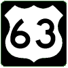 In other news, the new route of US 63 that bypasses Kirksville is now
open. Business Route 63 has been relocated to the former route of US 63,
along Baltimore Avenue in Kirksville. The new US 63 opened October 26.
The project was called the Alternate 63 project,
but it appears that designation, which would have been fairly unusual
in Missouri, won't be used now that the highway is built. MoDOT has an online
photo album of the opening ceremonies, including a surprising
sign goof. Also note that the opening
ceremonies appear to have occurred before the highway was completely
opened to traffic, based on what I can find online
(example from the Kirksville Daily Express).
In other news, the new route of US 63 that bypasses Kirksville is now
open. Business Route 63 has been relocated to the former route of US 63,
along Baltimore Avenue in Kirksville. The new US 63 opened October 26.
The project was called the Alternate 63 project,
but it appears that designation, which would have been fairly unusual
in Missouri, won't be used now that the highway is built. MoDOT has an online
photo album of the opening ceremonies, including a surprising
sign goof. Also note that the opening
ceremonies appear to have occurred before the highway was completely
opened to traffic, based on what I can find online
(example from the Kirksville Daily Express).
Hat tip to Gene Van Dusseldorp for reporting the information on various social media sites. The re-routing of US 63 and Business Route 63 don't affect the Route Log.
October 25, 2011
An update! On October 15, AAHSTO
(the American Association of Highway and State
Transportation Officials) conditionally approved Missouri's application to add
the Interstate 49 designation to US 71 between Interstate 435 in
Kansas City and the Arkansas state line. The approval is conditioned
upon the approval of Federal Highway Administration (FHWA). However,
FHWA had earlier entered into an agreement with Missouri for upgrading
US 71 to Interstate standards along the proposed route of I-49, so such
approval seems very likely. AAHSTO also approved Business Loop 49 designations
to replace Business US 71 routes in Butler, Nevada, Joplin, and Neosho,
also contingent upon final approval of the I-49 designation by FHWA.
For now, I have listed both designations for those four business routes.
March 4, 2011
It's the 13th anniversary of the site. However, due to many other commitments, I haven't done anything for the anniversary this year.I also removed the link to the misc.transport.road FAQ.
December 30, 2010
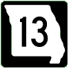 Thanks to David Backlin, who alerted me to the new route of
Missouri 13 in Warrensburg, the East Loop bypass. The first
stage of the bypass, starting from US 50 at its northern end, and
extending seven miles to the existing Highway 13,
opened November 23. As a consequence, the old route of Missouri 13
on Maguire Street is now designated as Business Route 13.
This stage of the project took about a year and a half to complete.
I have updated the Route Log to show the new Business Route 13
in Warrensburg.
Thanks to David Backlin, who alerted me to the new route of
Missouri 13 in Warrensburg, the East Loop bypass. The first
stage of the bypass, starting from US 50 at its northern end, and
extending seven miles to the existing Highway 13,
opened November 23. As a consequence, the old route of Missouri 13
on Maguire Street is now designated as Business Route 13.
This stage of the project took about a year and a half to complete.
I have updated the Route Log to show the new Business Route 13
in Warrensburg.
The next phase of the project is to complete the bypass from US 50 northward three miles to the current route of Missouri 13.
Also, thanks to David, I corrected the Route Log listing for Business Route 71 to include Webb City.
August 4, 2010
The Missouri Department of Transportation has announced that it
will seek the Interstate 49 designation, at least for US 71
between I-435 in Kansas City and I-44 in Jasper County. A two-year
program of upgrades to US 71, removing all at-grade road
crossings, will precede the application, planned
for 2012. More details and maps are available at the
MoDOT
Southwest District. The Route Log has been updated with
some of this information. The route is still shown as
proposed because the proposal has not yet been submitted
to AAHSTO
(the American Association of Highway and State
Transportation Officials).
July 1, 2010
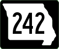 Added Missouri 242, the Horseshoe Bend Parkway Extension in
Lake Ozark, to the Route Log. Route 242 will connect the Lake of the
Ozarks Community Bridge and Business Route 54 with US 54 two miles to
the east. Along with Route MM, the route will eventually connect
Missouri 5 and US 54. The extension is planned to be complete in the
fall of 2011. Thanks to David Backlin for the tip. More information is
available from various Lake-area media, including
Lake
Expo, The Lake Today,
and radio station KRMS.
Added Missouri 242, the Horseshoe Bend Parkway Extension in
Lake Ozark, to the Route Log. Route 242 will connect the Lake of the
Ozarks Community Bridge and Business Route 54 with US 54 two miles to
the east. Along with Route MM, the route will eventually connect
Missouri 5 and US 54. The extension is planned to be complete in the
fall of 2011. Thanks to David Backlin for the tip. More information is
available from various Lake-area media, including
Lake
Expo, The Lake Today,
and radio station KRMS.
 I also revised the Route Log to reflect the correct
direction and terminus (northwest rather than northeast) of
Missouri 112 in Cassville. Thanks to David Backlin for the information,
which actually had been sitting on a
photo page for years. That correction was in turn stimulated by
a comment from Philip Diehl regarding the
four-route concurrence in
Branson West. Philip pointed out that Missouri 76, 86, and 112
were concurrent in Cassville along with Business Route 37. Even so,
I think it doesn't quite count as a four-route concurrence because
business routes don't seem to have as much "status" as even supplemental
routes; for example, you never see a numbered route end at a business route.
Well, almost never.
I also revised the Route Log to reflect the correct
direction and terminus (northwest rather than northeast) of
Missouri 112 in Cassville. Thanks to David Backlin for the information,
which actually had been sitting on a
photo page for years. That correction was in turn stimulated by
a comment from Philip Diehl regarding the
four-route concurrence in
Branson West. Philip pointed out that Missouri 76, 86, and 112
were concurrent in Cassville along with Business Route 37. Even so,
I think it doesn't quite count as a four-route concurrence because
business routes don't seem to have as much "status" as even supplemental
routes; for example, you never see a numbered route end at a business route.
Well, almost never.
Thanks, Philip and David, for helping me correct this longstanding error.
May 31, 2010
Removed links to the photo-count pages. Certain other sites liked to boast of their photo counts. I didn't want to participate in that boasting, because I think it doesn't mean anything, especially when you can't find those other sites' photos easily. The pages are still on the site, so you can find them if you know the URL, but they won't be updated automatically. I am keeping them because they've been useful for diagnosing occasional problems with the data used to index and search my photo pages.May 25, 2010
Updated links to Jeff Morrison's Iowa Highway Ends site and to H.B. Elkins' Millennium Highways site for Kentucky highways. Also pruned a couple of dead links.March 5, 2010
A day late this year, the anniversary update features official highway map scans from 1940 and 1950. March 4 was the site's 12th anniversary.December 22, 2009
This update implemented a more flexible architecture in the search program for city and county names for handling two-word and three-word city names as well as two-word county names. As a consequence, search results for those cities and counties should now be much more accurate.March 1, 2009
It's the Eleventh Anniversary Edition, published a few days early this year. Added are scans of the 1959 official Missouri highway map and, finally, scans of the front side of the 1969 official map to go along with the insets that have been shown here for many years. The 1959 map is significant because it's the first one to show completed segments of the Interstate highway system.
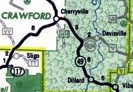 There's a new Route Log entry for Missouri 49A in Crawford County.
This route (left) appeared only on official maps from 1966
to 1974 inclusive. It's now Route V between Missouri 49 and Davisville.
The route may have had other designations before 1966. It often appeared
on official state highway maps as a primary route rather than a secondary
route. In 1932, a route from Missouri 19 to Davisville was shown as Missouri 19A.
The same route was shown in 1935. South of the Davisville junction, what is now
Missouri 49 was designated Route B. In 1936, the designation of Missouri 49
was extended west and north from Glover (at Missouri 21 and Missouri 72) to
end at Missouri 19 at Cherryville. Still, the route segment between
Cherryville and the spur to Davisville, and then the spur itself, was shown
as a primary route while the rest of Missouri 49 was shown as a secondary route.
It's possible that the spur was Spur 49 or even was 49A from 1936 onward,
but it was not designated as anything on the official maps until 1966.
Current MoDOT maps definitely show it as Route V, so there's no ambiguity
about its present status.
There's a new Route Log entry for Missouri 49A in Crawford County.
This route (left) appeared only on official maps from 1966
to 1974 inclusive. It's now Route V between Missouri 49 and Davisville.
The route may have had other designations before 1966. It often appeared
on official state highway maps as a primary route rather than a secondary
route. In 1932, a route from Missouri 19 to Davisville was shown as Missouri 19A.
The same route was shown in 1935. South of the Davisville junction, what is now
Missouri 49 was designated Route B. In 1936, the designation of Missouri 49
was extended west and north from Glover (at Missouri 21 and Missouri 72) to
end at Missouri 19 at Cherryville. Still, the route segment between
Cherryville and the spur to Davisville, and then the spur itself, was shown
as a primary route while the rest of Missouri 49 was shown as a secondary route.
It's possible that the spur was Spur 49 or even was 49A from 1936 onward,
but it was not designated as anything on the official maps until 1966.
Current MoDOT maps definitely show it as Route V, so there's no ambiguity
about its present status.
December 28, 2008
 Added to the collection of official state highway maps are those from
1936 and
1937. There have also been
corrections to some of the descriptive text for the
1938 map. When comparing the
1937 and 1938 maps, I also discovered that 1938 was the first year
that Missouri 340 in St. Louis County was designated. As a consequence,
I have updated the Route Log. With all the additions, I'm now considering
the site to be at Version 8.2.
Added to the collection of official state highway maps are those from
1936 and
1937. There have also been
corrections to some of the descriptive text for the
1938 map. When comparing the
1937 and 1938 maps, I also discovered that 1938 was the first year
that Missouri 340 in St. Louis County was designated. As a consequence,
I have updated the Route Log. With all the additions, I'm now considering
the site to be at Version 8.2.
December 22, 2008
As part of my trip over all three miles of Missouri 269 in September 2008,
I took a few pictures of the new Chouteau Bridge (constructed in 2001).
Three of those photos are now in
the Chouteau Bridge section
of this site, letting you compare the rustic scene on the north end
of the bridge in 1998 with the way it looks in 2008 (not so rustic).
Additional changes, December 23, 2008: I changed the text on a few pages to try to clarify the status of the southern terminus of Missouri 269. Since 1985, official Missouri maps have shown the endpoint at the north landing of the Chouteau Bridge. But my 1998 photo shows an "End 269" sign assembly at Missouri 210, a few hundred feet north of the bridge. So now, despite lack of popular demand, here's the complete history of Missouri 269 as I know it from official highway maps:
- 1953: First designated, extending only from Missouri 10 (probably today's Parvin Road) to the north end of the Chouteau Bridge.
- 1956: Extended south of the Missouri River to "Temporary 269", running approximately (north to south) to Front Street, to Gardner Avenue, to Chestnut Trafficway, and thence south to its new terminus at Independence Avenue.
- 1958: Same route, no longer marked as "temporary".
- 1960: Re-routed south of the river, along present-day Chouteau Trafficway and Belmont Avenue south to another terminus at Independence Avenue.
- 1961: North end of the route extended north from approximately Parvin Road to Interstate 35.
- 1985: Decommissioned south of the river, southern terminus is again at the Chouteau Bridge.
- It's not known when the northern endpoint was moved south from I-35 to its present location at Winn Road.
I've also updated the Route Log entry for Missouri 269 to reflect this complex history in shortened form.
December 21, 2008
 I've added one more group of photos from my September 2008 trip
to Missouri, this time in a fairly narrow geographic area: Kansas
City and vicinity in Clay and Platte Counties. Included are end-to-end
views of Missouri 283, plus Missouri 269, 210, and 9; unmarked
Spur 45 in Waldron; and US 69. This time, I've added 19 photos on 18 pages.
I've added one more group of photos from my September 2008 trip
to Missouri, this time in a fairly narrow geographic area: Kansas
City and vicinity in Clay and Platte Counties. Included are end-to-end
views of Missouri 283, plus Missouri 269, 210, and 9; unmarked
Spur 45 in Waldron; and US 69. This time, I've added 19 photos on 18 pages.
- Mile marker on Interstate 435 in Platte County
- Interstate 435 as alternate Interstate 29 in Platte County
- Junction of Missouri 283 with Missouri 9
- Junction of Missouri 9 at the southern endpoint of Missouri 283 in North Kansas City
- Contrasting city-limits sign styles for Kansas City
- Arrow indicators but no markers on US 69 at Missouri 283 in Kansas City
- Big green sign for Missouri 210 at Missouri 269 in North Kansas City
- Missouri 210 and Missouri 269 in North Kansas City
- Hyper-detailed Missouri outline for Missouri 9 at US 69 in Riverside
- Big green sign at the Missouri 9-283 split in North Kansas City
- End of Missouri 269 (northern endpoint)
- End of Missouri 283 (northern endpoint)
- North Missouri 283 at its southern end
- End of Missouri 283 (southern endpoint)
- View of unmarked Spur 45 at its endpoint in Waldron (northbound)
- View of unmarked Spur 45 at its endpoint in Waldron (southbound)
- US 69 as Vivion Road in Kansas City
- West and East Missouri 210 in North Kansas City
December 13, 2008
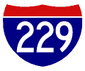
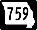 Here's the second group of photos from my September 2008 trip to
Missouri, this time featuring routes in St. Joseph, especially
Interstate 229 and Missouri 759 (the Stockyards Expressway).
Here's the second group of photos from my September 2008 trip to
Missouri, this time featuring routes in St. Joseph, especially
Interstate 229 and Missouri 759 (the Stockyards Expressway).
The Route Log has also been updated with historic information for Missouri 740 (correction), Missouri 752, Missouri 759, Missouri 763, and Missouri 765.
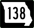 In addition, Spur 138 has been added to the
Route Log. It has appeared only on a recent MoDOT Buchanan county
map. It appears to be a very short spur within Lewis &
Clark State Park. Missouri 138 is itself a spur into the park from
Missouri 45 and 273. Because it's within a state park, the spur is
probably not marked. This is probably the first spur of a
spur that I've found in Missouri.
In addition, Spur 138 has been added to the
Route Log. It has appeared only on a recent MoDOT Buchanan county
map. It appears to be a very short spur within Lewis &
Clark State Park. Missouri 138 is itself a spur into the park from
Missouri 45 and 273. Because it's within a state park, the spur is
probably not marked. This is probably the first spur of a
spur that I've found in Missouri.
- Missouri 759, the Stockyards Expressway in St. Joseph (city street sign)
- Missouri 759 overhead sign in St. Joseph
- Freeway-style guide signs for US 36, US 59, Interstate 229, and Missouri 759 in St. Joseph
- Freeway guide signs for US 59 and US 36 from Interstate 229 in St. Joseph (view from Missouri 759)
- Interstate 229 double-decker in St. Joseph (south end)
- Southeastern end of Interstate 229 at Interstate 29 and US 71 in St. Joseph
- Southern end of Kansas 238, the route to the St. Joseph airport in Missouri
- End of Missouri 752 at Interstate 229 in St. Joseph
- End of Missouri 759 (northern endpoint)
- Final southbound mile marker for Interstate 229 in St. Joseph
- Advance exit sign (1 mile) for Interstate 229 on northbound Interstate 29 in St. Joseph
- Advance exit sign (2 miles) for Interstate 229 on northbound Interstate 29 in St. Joseph
- Mile marker for northbound Interstate 29 in St. Joseph at the Interstate 229 exit
- Kansas 238 at US 36, headed to the St. Joseph airport
- Exit for Missouri 752 from Interstate 229 in St. Joseph
- Northern end of Kansas 238 at the St. Joseph airport
- Mile marker for Interstate 229 in St. Joseph (northbound)
- North Kansas 238, the route to the St. Joseph airport
- North Missouri 759 at its southern endpoint
- Mile marker for Interstate 229 in St. Joseph (southbound)
- South Missouri 759 and West US 36 in St. Joseph
- St. Joseph city limits
- End of Missouri 759 (southern endpoint, unmarked)
- US 36, Interstate 229, Missouri 759, and US 59 in St. Joseph
December 10, 2008
The first batch of photos from my September 2008 trip to Missouri make their appearance. There are 37 photos on 36 pages, mostly in west-central Missouri but with a few from Kansas City, too.- Destination sign at end of Missouri 11 west of Brunswick
- Business Routes 10 and 13 and northbound Missouri 13 in Richmond
- Business Missouri 10 concurrent with Business Missouri 13 in Richmond
- Business Missouri 10 and supplemental route trailblazer in Richmond
- Business US 65 and Missouri 10 in Carrollton
- End of Missouri 11 near Brunswick
- End of Missouri 122 in Saline County
- End of Missouri 139 in Carroll County
- End of Missouri 41 near De Witt
- Large sign indicating dead-end at Missouri 11 and US 24 near Brunswick
- West Missouri 10 at Route J at the Hardin city limits
- Missouri 33, Interstate 35, and US 69 in Liberty
- Junction of Missouri 122 and Route NN in Saline County
- Junction of Missouri 13 and Business Missouri 13 in Richmond
- Destination sign for Miami and Slater on Missouri 41 in Saline County
- Missouri 11 and US 24 west of Brunswick
- Missouri 122 at its junction with Missouri 41 in Saline County
- Unmarked end of Missouri 122 at Van Meter State Park
- Missouri 139 in Carroll County
- Missouri 41, Missouri 122, and Route NN in Saline County
- Unusual signal arm on Missouri 10 in Norborne
- End of Interstate 470 in Independence
- Mile marker on Interstate 470 in Lee's Summit
- North Missouri 11 near Brunswick
- North Missouri 139 in Carroll County
- North and West Interstate 435 in Kansas City
- North and West Interstate 435 along with destination sign in Kansas City
- Lighted Red Signal Ahead sign on Watkins Drive at Gregory Boulevard in Kansas City
- Business Routes 10 and 13 at Missouri 13 in Richmond
- Richmond as mushroom capital
- South Missouri 291 exit from Interstate 470 in Lee's Summit
- Two directions for historical markers on Missouri 41 in Saline County
- Unmarked Spur Missouri 41 in Miami
- US 24 and Missouri 139 in Carroll County
- US 65, Missouri 240, and trailblazer to Missouri 41 in Marshall
November 11, 2008
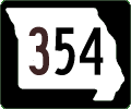 G.R. Van pointed out that the official Missouri highway map for 1968
showed a route designated Missouri 354 in Lake Ozark. Missouri 354
appeared only that year; the next year, it was shown as Business US
54, its current designation. As a consequence, Missouri 354 has
been added to the Route Log. Thanks, G.R., for the sharp-eyed find!
G.R. Van pointed out that the official Missouri highway map for 1968
showed a route designated Missouri 354 in Lake Ozark. Missouri 354
appeared only that year; the next year, it was shown as Business US
54, its current designation. As a consequence, Missouri 354 has
been added to the Route Log. Thanks, G.R., for the sharp-eyed find!
September 8, 2008
Added a scan of the 1958 official Missouri highway map, including insets. This was the last map that did not show Interstate highways -- although Interstate construction was shown on the Columbia and St. Charles inset maps. Changes were also made for some pages covering the 1957 and 1956 official maps. I was able to compare the 1957 insets with the 1958 insets, thus being able to correct some errors in the 1957 descriptions. Also, for consistency with the 1958 and 1948 maps, a few file names in the 1956 and 1957 map galleries were changed. As a consequence, I'm bumping up the version number to 8.1.
 Also updated the Route Log entry for Missouri 249 (the Range Line
Bypass east of Joplin), to reflect its completion between
Missouri 171 in Carterville and Interstate 44. Also updated the
Route Log entry for Missouri 144 to reflect an earlier
designation of Missouri 144 in southwest Missouri that predated
the current route in southeast Missouri by 15 years or so.
Also updated the Route Log entry for Missouri 249 (the Range Line
Bypass east of Joplin), to reflect its completion between
Missouri 171 in Carterville and Interstate 44. Also updated the
Route Log entry for Missouri 144 to reflect an earlier
designation of Missouri 144 in southwest Missouri that predated
the current route in southeast Missouri by 15 years or so.
August 8, 2008
Rearchitected the entire Signs & Sights family of sites. All URLs changed and are now shorter. Also merged the Missouri Signs & Sights site with the Missouri Highways site. The easy way to convert any given URL from the old Signs & Sights site: remove /road/sign from the old URL to get the new URL. URLs from the old Missouri Highways site were moved around differently, with the Numbering System page moving to http://www.cosmos-monitor.com/mo/etc/numbering.html, and the Route Log moving to http://www.cosmos-monitor.com/mo/routelog.html.June 29, 2008
Added links to the new and improved New Mexico Signs & Sights Gallery.March 4, 2008
I fixed several bugs in the search programs which sometimes gave inaccurate results. For example, "Lake Ozark" will now return just Lake Ozark, and not "Ozark" as well.January 2, 2008
Added a link on the home page for the gallery to David Backlin's US 71 Flickr site. David has contributed many photos over the years to the sign galleries here; look forward to more at his new pages. (Note: the link was changed January 12 to reflect an updated user name.)December 30, 2007
Here's one more set of contributions before the end of the year, all from David Backlin in the Springfield and Joplin areas. There are eight new pages with a total of nine new photos. Thanks again, David!- Advance sign for Missouri 360 on the eastbound James River Freeway in Republic
- Wide and square supplemental markers for Route VV at Missouri 249 in Joplin
- Sign for Springfield-Branson National Airport on the James River Freeway near Republic
- Slow-down warning on sign post in Nixa
- Missouri 249 and (small-shield) Interstate 44 used as destinations from Zora Street in Joplin
- Route VV along with Missouri 249 along Zora Street in Joplin
- Business US 71 shield on destination sign from Missouri 249 exit in Joplin
- Route VV exit from Missouri 249 at Zora Street in Joplin
December 28, 2007
Eleven nice contributions from David Backlin, David Herman, and Rich Piehl round out our selections for December. Thanks to all three of you for the photos!- Business US 61 and Route B at the end of Missouri 16 in Canton
- Detour Business US 71 with stick-on letters at Route EE in Pineville after US 71 was relocated in 2007
- Verbal description for US 60 at the Missouri 360 exit from Interstate 44
- Circle outline for Missouri 370 marker at the Katy Trail in St. Charles
- Pictographic speed zone sign on Missouri 79 in Elsberry
- Junction of Interstate 64 on Missouri 94 in St. Charles County
- Safety message on a stop-sign post in Nixa
- Old-style bridge on old US 61 at the North Fabius River in Marion County
- Narrow font on a destination sign along Business US 71 in Webb City
- Truck lane restriction on Interstate 70 near Cave Springs in St. Peters
- Graphical exit sign for Missouri 370 along with truck restriction on Interstate 70 in St. Peters
December 26, 2007
Here's the final set of photos, 38 in all, from my trip to Missouri in September and October 2007. That makes a total of 93 photos posted from that trip!- Exit for Missouri 135 and Missouri 41 from Interstate 70 in Cooper County (advance sign)
- Exit for Missouri 135 and Missouri 41 from Interstate 70 in Cooper County
- Missouri 98 and Missouri 179 exit from Interstate 70 in Cooper County
- Missouri 100 joins Missouri 19 at First and Market Streets in Hermann
- Missouri 19 and 100 split at Frene Creek in Hermann
- Vertically stacked markers for Missouri 19 and Missouri 100 in Hermann
- Missouri 19 intersects with US 50 in Gasconade County
- Missouri 28 at the end of Missouri 42 south of Belle
- Missouri 19 and Missouri 28 run concurrently in Owensville
- Missouri 28 and hidden Spur 28 at US 63 in Maries County
- Missouri 28 at Route Y in Maries County
- Missouri 42 at US 63 in Vienna
- Missouri 5 exit from Interstate 70 in Boonville
- Missouri 98 terminates at Missouri 87 and Business Loop 70 east of Boonville
- Missouri 89 at the Spur 89-Missouri 89 split
- Missouri 89's southernmost intersection, with Missouri 28 in Belle
- Spur 89 at Missouri 89 in Osage County
- Low weight limit on bridge along Missouri 94 in Warren County
- Missouri 94 and Missouri 19 intersect in Montgomery County
- Missouri 47 at Missouri 94 just west of Marthasville
- Missouri 94 at Route N in Treloar
- Missouri 94 at Route TT in Dutzow
- North Spur 89 in Osage County
- Santa Fe Trail sign at Arrow Rock
- South Missouri 19 and West Missouri 100 with Lewis and Clark marker in Hermann
- Missouri 87 and Business Loop 70 east of Boonville
- South Missouri 89 in Chamois
- South Spur 89 in Osage County
- City trailblazer from Missouri 94 to Interstate 70 on the north side of St. Charles
- Trailblazer to US 50 at the Missouri 89-Spur 89 split in Osage County
- Amtrak train passing under the bridges crossing the Missouri River at Hermann (October 2007)
- US 50 and Missouri 100 in Linn
- Spur 89 at US 50 in Osage County
- Graphic representation of the US 50/US 63 intersection in Osage County
- Destination sign for Vienna and Vichy on Missouri 28
- West Missouri 100 with Lewis and Clark near Hermann
- West Missouri 370 and East Missouri 94 in St. Charles
- Missouri 94 in the Frenchtown section of St. Charles
December 11, 2007
I added one photo from the Hermann collection that I had inadvertently omitted from the November 24 update. The additional photo was taken on Missouri 19 almost upon entering the new bridge. So now there are 19 photos of the bridge!November 24, 2007
A new section of the Signs and Sights Gallery adds 18 photos of the new and old bridges across the Missouri River at Hermann. These photos were taken in October 2007 when the bridges were standing side-by-side, except for the removal of the southernmost section of the old bridge.This update also fixed a broken link on the Interstate 72 page.
November 10, 2007
Here's the first set of photos from my October 2007 trip to Missouri. I've added 36 photos in this update. One additional photo has been revised (a photo in Dixon, indicated below). More pictures to come soon, especially of the new Hermann bridge across the Missouri River!- Clark Bridge on US 67 between Illinois and Missouri (profile view)
- Clark Bridge on US 67 between Illinois and Missouri
- Clark Bridge on US 67 between Illinois and Missouri (US 67 in foreground)
- Confusing detour markers for Missouri 367 in St. Louis County (2007)
- Junction of Missouri 28 in Dixon (2007)
- A destination sign for other routes on Missouri 28 in Dixon (2002) (renamed to link to the next page)
- Destinations for major but distant highways from Dixon, Missouri (2007)
- Missouri 28 east of Dixon
- East Missouri 42 in Vienna
- Missouri 370 freeway entrance from Missouri 94 in St. Charles
- Missouri 94 with Lewis and Clark Trail marker in St. Charles
- End of Missouri 367 at US 67 in St. Louis County
- End of Missouri 42 south of Belle
- End of Missouri 89 in Belle (southern endpoint)
- End of Missouri 89 in Chamois (northern endpoint)
- End of Missouri 94 in West Alton
- End of Missouri 100 in Linn
- End of Missouri 187 in Howard County
- Missouri 187 at Missouri 87 in Howard County (northbound)
- Missouri 187 at Missouri 87 in Howard County (southbound)
- Railroad overpass at the end of Missouri 94 near US 67 in West Alton
- Junction assembly for Missouri 5, Missouri 87, and Business Missouri 240 on the other side of the Missouri River from Glasgow
- The Missouri 240 approach on the west side of the Missouri River bridge opposite Glasgow (2007)
- The west side of the Missouri River bridge on Missouri 240 opposite Glasgow (2007)
- Missouri 5, Missouri 87, Missouri 240, and Business Route 240 along with the Glasgow city limit sign
- Liability warning sign in a Hermann city park
- Hermann city limits at the Gasconade county line
- Katy trail marker for Missouri 94, using a circle, in Montgomery County
- Trailblazer for Lewis and Clark historical marker at the eastern endpoint of Missouri 94
- Right-of-way marker on US 50 in Linn
- Missouri River sign on the north side of the bridge at Hermann
- Missouri 100 in Chamois at the end of Missouri 89
- Missouri 100 as it joins Missouri 19 in downtown Hermann
- Markers for Missouri 100 and Missouri 19 on the Hermann bridge across the Missouri River (2007)
- Missouri 100 joins Missouri 19 on the south side of Hermann
- Katy trail marker for Missouri 94, using a circle, in Montgomery County (close-up)
- MoDOT Drive Smart sign, on the ground in Hermann
October 14, 2007
David Backlin contributes six photos from southwestern Missouri. Thanks again, David!- Albatross community sign
- Freeway entrance sign for US 60 and Missouri 5, including Route EE, in Mansfield
- Missouri 360 exit from Interstate 44, indicating connection to US 60, near Republic (advance sign)
- Missouri 360 exit from Interstate 44, indicating connection to US 60, near Republic
- Horse-and-buggy warning sign on US 60 in Seymour
- Horse-and-buggy cross-traffic on US 60 in Seymour
October 12, 2007
Four more from David Herman, including the ever-popular wrong-outline goof: this time, US 136 in the northwest corner of Missouri has markers instead for "Missouri 136". Thanks, David!September 23, 2007
Thanks to David Herman for four contributions of signs around Branson and vicinity, including this site's first-ever entry for Missouri 376!September 1, 2007
Contributions from all around Missouri include a noticeable misspelling on US 61 in Lincoln County from Rich Piehl, unusual detour markers on Interstate 255 from David Herman, another Missouri marker shape from G.R. Van, and a brand-new section of US 71 in McDonald County complete with stick-on letters for Business US 71, contributed by David Backlin. Thanks to all of you!- Misspelled Moscow Mills on US 61 in Lincoln County
- Detour signs with odd marker fonts and shapes for Missouri 231 on Interstate 255
- Unusual state outline shape for Missouri 58 marker in Raymore
- Detour Business US 71 with stick-on letters in Pineville after US 71 was relocated in 2007
- US 71 at Business US 71 in Pineville, with stick-on letters for the Business designation
- Gantry for US 71 south of Pineville
- Southbound US 71 south of Pineville heading into Arkansas
- Destination sign for US 71 at newly-opened interchange in 2007 near Pineville
July 24, 2007
David Herman sends along three signs showing the new Missouri 221 designation in Iron and St. Francois counties. David also includes a destination sign for US 66 in Webster Groves. Thanks, David!June 25, 2007
David Backlin submits four new photos from Missouri, including a new goof -- US 269 instead of Missouri 269 in Kansas City. Thanks, David!May 12, 2007
Rich Piehl sends in this photo from Interstate 70 that's not exactly a goof, but still weird. Thanks, Rich!April 7, 2007
Here's an update about the "US 58" photo in Johnson County. Brandon Henderson checks back in to report that the sign has been changed. The "US 58" goof has been removed. But, thanks to Brandon, we still have the evidence!April 1, 2007
New photos from David Backlin (Nixa and Cassville), David Herman (St. Louis), and G.R. Van (Kirksville). Along with his photo, G.R. also provided updated status on Business US 63 in Kirksville, which was decommissioned in 2001 or 2002. G.R. took a photo of the same intersection that I took in 1998; I've updated the text for my 1998 photo to reflect the subsequent changes. Thanks, everyone, for your contributions!- End of Missouri 231 at St. Louis city line
- Renamed and updated: US 63 plus Missouri 6 and Missouri 11 with Business US 63 in Kirksville (1998)
- US 63, Missouri 6, and Missouri 11 without Business US 63 in Kirksville (2007)
- Mistaken use of directional arrows at Missouri 13 and Missouri 14 intersection with US 160 in Nixa
- Alternating passing lanes on Missouri 37 north of Cassville
- Trailblazer for Missouri 14 in a Nixa shopping center, words only
March 4, 2007
Thanks to G.R. Van of "My Land of Misery" for a photo of a new marker on Missouri 129 near New Cambria. Thanks also to Rich Piehl for contributions from St. Charles County. Once again, thanks also to David Backlin for bunch of photos taken in 2004. In total, this update features 35 new photos!- Button reflectors on exit sign for Routes B and A on US 71 near Archie
- Billings city limit sign featuring local singer Leon Rauch
- Older-style Business Loop 44 marker in Springfield
- Button reflectors for Brooklyn Heights exit from Business US 71 and Missouri 171
- Button reflectors on destination sign for Brooklyn Heights
- Warning sign for horse and buggy traffic on Missouri 13 near Lowry City
- Exit sign with button reflectors for Business US 71 from US 71 in Butler
- Button reflectors on destination sign for Butler at the Business US 71 exit from US 71
- Original north endpoint of Missouri 249 at Zora Street in Joplin
- East endpoint of Missouri 66 with a Keep Left sign east of Duenweg
- Exit from US 71 with faded sign, button reflectors, and small supplemental route markers at Peculiar
- Neon arrow pointing the way to Goodman from Missouri 59
- Missouri 249 at Routes HH and AA in Carterville (all wide-style markers)
- Missouri 249 and Route HH in Carterville, both wide-style markers with no directional banners
- Larger-style destination sign with button reflectors at Interstate 44 freeway entrance for Leasburg
- Junction of Missouri 248 near Reeds Spring
- Button reflectors on destination sign along Interstate 44 west of Cuba
- Keep Left sign at the eastern endpoint of Missouri 66
- Street sign for former US 71 at Missouri 18 in Adrian with destination sign for Merwin
- Metric destination sign for distance to St. Louis from Rolla on Interstate 44
- Missouri 129 just off US 36 west of New Cambria (pointy style, new in 2007)
- Junction of Missouri 249 concurrences with Routes AA and HH in Carterville
- Advance sign for original north endpoint of Missouri 249 at Zora Street in Joplin
- description in menu
- Missouri 13 and Missouri 86 north of Blue Eye
- Yellow stop sign at the Lexington post office
- Warning for upcoming red lights on Missouri 13 north of Springfield
- End of Missouri 249 in Carterville
- Older-style button-reflector destination sign for Cuba and St. Clair on Interstate 44 at Sullivan
- Warning sign and lights for train crossing at US 60 and US 65 in Springfield
- Unusually pointy Interstate 70 marker in St. Peters
- No Passing Zones Unmarked on a Franklin County road
- Advance sign for Missouri 13 (now Missouri 413) and US 60 at the James River Freeway in Brookline (2004)
- US 60 and the Trail of Tears historic route west of Aurora
- Exit for westbound US 60 at southbound US 65 in Springfield
January 20, 2007
The "version 7" page of links has been removed from the site, in hopes of making maintenance less burdensome and allowing me more time to work on content.January 1, 2007
Thanks to David Backlin for these seven photos from Joplin and Springfield, including three (count them, three!) goofs along Missouri 249 east of Joplin.- Destination sign for Joplin and Springfield on a county road near Joplin
- Business US 71, Missouri 171, Missouri 249, and Route HH in Carterville
- Junction of Interstate 44 and US 71 with directional banners on Missouri 66 east of Joplin
- Route markers on mileage signs for Interstate 44 west of Springfield
- US 249 for Missouri 249 near Joplin
- US 249 for Missouri 249 on Zora Street near Joplin
- US 249 for Missouri 249 at Missouri 66 and Business Loop 44 east of Joplin
December 3, 2006
Thanks to David Herman for this contribution from Hannibal.Also added a link to G.R. Van's My Land of Misery, featuring photos of Missouri highways, along with other items of highway-related interest.
November 14, 2006
Thanks to David Backlin for three contributions from southwestern Missouri.The last photo in the list above is an update of a sign assembly photographed in 2004. The 2006 version has the new-style "meat cleaver" Oklahoma marker. I have updated the text for the page showing the photograph that was taken in 2004:
November 12, 2006
Thanks to Brandon Henderson for catching a goof on this destination sign along US 50 in Johnson County!October 1, 2006
I removed all the direct e-mail links from the pages that had those links. This is an attempt to reduce a particularly difficult type of spam that has begun showing up at my e-mail provider. A new e-mail address is provided on a separate Contact Information page.August 19, 2006
Thanks to David Herman for four more contributions, including the ever-popular construction goof where the state route marker is used for a US route, this time on US 61. Also updated the links to the Missouri Department of Transportation web site, which is now at http://www.modot.mo.gov.- Missouri 168 exit from US 24 and US 61 near Palmyra
- Missouri 61 for US 61 in Clark County (2006)
- Missouri 6 at US 24 and US 61 in Marion County
- Trailblazer to Missouri 81
- Missouri 16 exit from US 61 near Canton (adds a link to the new Missouri 81 trailblazer photo)
August 12, 2006
Thanks to David Herman for a couple of contributions from Missouri 21 in St. Louis County, including a "wide" style marker used to designate Route 21!August 5, 2006
A big thanks to John Brocato, for his contribution of a photo confirming the existence of Route AX in Macon County. This is the only state supplemental route that uses the letter X.July 23, 2006
It's the final installment of photos from H.B. Elkins. This time it's 20 photos from south-central Missouri and the Bootheel, taken in June 2001. A big thanks to H.B. for sending these photos along!- Routes K and Y near Macomb
- Business US 60 to Mountain Grove
- Business US 60 in New Madrid County (junction sign)
- Junction of Missouri 99 in Birch Tree
- US 60 at Missouri 17 in Mountain View
- Missouri 25 and Business US 60 in Dexter
- Missouri 76 and Missouri 137 in Willow Springs (interchange where the two routes end)
- Business US 60 and US 63 exit from US 60 at Cabool (advance sign)
- Business US 60 and US 63 exit from US 60 at Cabool
- Interstate 57 and US 60 in Mississippi County
- South endpoint of Interstate 57 at Interstate 55 in Scott County
- Business US 60 and US 60 in New Madrid County
- US 60 and Missouri 17 east of Mountain View
- Missouri 21 and 34 intersect with US 60 in Carter County
- US 60, Missouri 99, and Route FF in Birch Tree
- US 60, US 62, Missouri 77, and two supplemental routes in Mississippi County
- US 60 and Business US 60 in Poplar Bluff
- Business Loop 57 along with US 62 and Missouri 77 in Charleston
- US 63 and US 60 intersection near Willow Springs (advance sign)
- US 63 and US 60 intersection near Willow Springs
July 16, 2006
Part two from H.B. Elkins, with 17 more photos, including photos of Missouri 13 in southwest Missouri before it was rerouted in 2002. All photos are from June 2001. Thanks again, H.B.!- US 60, Missouri 13 (now 413), and Missouri 14 in Billings (2001)
- Granby water tower
- Missouri 59, US 60, and Business US 71 in Neosho
- Short concurrence of Missouri 86 with Missouri 59 and US 60 in Newton County (west end)
- Short concurrence of Missouri 86 with Missouri 59 and US 60 in Newton County (east end)
- Construction warning sign for Missouri 13 on US 60 (2001)
- Missouri 59 and US 60 in Newton County
- Destination sign for Fort Smith, Arkansas at the US 71/US 60 interchange southwest of Neosho
- US 60 and US 71 interchange southwest of Neosho
- US 60, Business US 60, and Missouri 59 in Newton County
- US 60 and Business US 65 in Springfield
- US 60, Missouri 13, and Missouri 14 in Billings (advance sign, 2001)
- US 60, Missouri 13, and Missouri 14 in Billings (2001)
- Showing four types of markers: US 60 and Missouri 13 at Routes M and MM along with an Interstate 44 trailblazer in Republic (2001)
- US 60 and Missouri 37 and the Ozark Trail scenic route in Monett
- US 60 intersects with Missouri 39 and Missouri 265 in Aurora
- US 71 and Missouri 76 near Anderson (2001)
July 4, 2006
A big thanks to H.B. Elkins for photos that he took during a June 2001 roadtrip through southern Missouri (and apologies for taking so long to get these photos posted)! The 16 photos added on July 4 is the first set in a series of photos from H.B.'s trip; look for more photos in upcoming weeks.- US 62 concurrence with Missouri 25 south of Malden
- End of Business Missouri 25 in Malden
- Interstate 57 and US 60 at Interstate 55 (advance exit sign)
- Missouri 25, Business Missouri 25, and US 62 in Malden
- Missouri 25 and US 62 split at Malden
- Missouri 80 exit from Interstate 55 near Matthews
- Interchange of Interstate 55, Interstate 57, and US 60 in Scott County
- The Missouri-Arkansas border at the St. Francis River
- Pointing to a ferry to Kentucky on Interstate 55 in New Madrid County
- US 60 at Missouri 51 in Stoddard County
- US 61 and US 62 concurrence south of Howardville (2001)
- US 60, US 62, Missouri 77, and Route Y in Wilson City
- US 62 near the Missouri-Arkansas state line
- US 62 and Missouri 53 in Campbell
- US 62 and US 61 intersect south of Howardville (2001)
- Missouri 53, US 62, and Route WW in Campbell
July 3, 2006
Thanks to Rich Piehl for a photo of a construction goof in St. Louis County, and David Backlin, for a photo from April in southwestern Missouri.June 25, 2006
David Backlin has sent along eight photos from the Kansas City area taken this month. Thanks, David!- Kansas City downtown loop: Exits 2G and 2H (advance sign on Interstate 35)
- Kansas City downtown loop: Exits 2G and 2H
- Kansas City downtown loop: Exits 2J, 2L, and 2M
- Kansas City downtown loop: Exit 3 (northeast corner)
- Paseo Boulevard just south of the Paseo Bridge in Kansas City (2006)
- Armour Road at Interstate 29 and 35 in Kansas City
- Advance signs for the Grandview Triangle interchange from US 71 in Kansas City
- Watkins Drive (US 71) at the downtown Kansas City freeway loop
David's photo of the Paseo exit matches this photo that I had taken in 1998. This is not a new photo, but I have updated the page to indicate that the signs have changed. The file has also been renamed to ensure that the 1998 and 2006 photos are indexed closely together.
June 22, 2006
Thanks to Rich Piehl for two photos of a new, unusual warning sign on Interstate 70 in St. Louis County (both on one page).May 25, 2006
A design facelift for the entire site! The biggest changes are at the Missouri, California, and US Highways Signs and Sights Galleries, where the top-level index page has been replaced by a search page, enabling you to quickly find photos for specific routes, types of routes, or categories of photos. You can also search for photos relating to specific cities or counties.Other than the new search pages, the most notable changes seen by most users will be the new fonts used across the entire site. The new design should also look a little bit better with Internet Explorer 6 than the old design.
April 1, 2006
Charles Sarjeant submitted this photo of the Interstate 44 interchange with Missouri 47 in St. Clair. Thanks, Charles!March 29, 2006
Added an index by photo category to the other category indexes.March 27, 2006
Thanks to David Herman, with 10 new photos from the St. Louis area and northeast Missouri, including Missouri 27.- Business US 61 exit from US 61 south of LaGrange
- End of Missouri 100 in St. Louis
- Interstates 44, 55, 64, and 70 in St. Louis
- Missouri 27 at US 61 in Clark County
- Removing a defunct route from a destination sign in St. Louis County
- US 136 exit from Missouri 27 in Clark County
- US 24 at US 61 in Marion County
- US 24 and US 61 concurrence in Marion County
- US 50 mistakenly added to US 61 and US 67 on Lemay Ferry Road in St. Louis County
- US 40/Interstate 64 and US 61 at Missouri 340 in Chesterfield
March 4, 2006
Added a photo by Charles Sarjeant, showing the new northern endpoint of Missouri 79 and Business Route 36 in Hannibal:Thanks, Charles! As a consequence, I also updated the text on a couple of other pages showing routes in Hannibal in 1998.
Also check out scans of Missouri official highway maps from 1952, 1956, and 1969, also added on March 4 to mark this site's 8th anniversary.
January 29, 2006
Moved all Missouri photos from the US Highways Signs and Sights Gallery to the Missouri gallery. In the migration, 56 pages with 61 photos were moved into the Missouri gallery. The move was made to consolidate Missouri photos into one gallery. It will also allow better optimization of searching and indexing programs. The pages that were moved are listed here:- Eastern endpoint of US 160 in Poplar Bluff (westbound direction)
- US 169 freeway mileage markers in Kansas City
- Business US 60 and Business US 67 in Poplar Bluff
- Business US 65 in Springfield
- Business US 71 in Anderson
- Business US 71 in Butler
- Business US 50 in Jefferson City
- Business US 54 exit from US 54 near Eldon
- Business US 54 and Missouri 52 exit from US 54 near Eldon
- Business US 54 and Missouri 52 south of Eldon
- Business US 60 plus US 61 and US 62 near Sikeston
- Long-defunct Business US 63 in Columbia (2002)
- End Business US 36 in Macon
- Approaching endpoint of Interstate 57 on US 60
- Eastern endpoint of US 160 in Poplar Bluff (eastbound direction)
- Business US 67 near Fredericktown
- Historic US 66 in Bourbon
- Blue arrows for Interstate 29 and US 71 in Platte Woods
- Junction of Business US 65 and US 65 in Trenton
- Three-digit marker for US 275 in Rock Port
- All cardinal directions on US 50 and US 63 in Jefferson City
- US 66 in Joplin (late 1990s construction marker)
- Destination sign for Interstate 29, US 71, and Interstate 435 in Kansas City (airport)
- A wide-style Missouri three-digit shield, rare until 2000
- Business US 36 in Hamilton (old button copy)
- Business US 65 in Trenton
- A Missouri three-digit shield for US 160 with narrow digits
- US 66 signs in Missouri
- The standard Missouri three-digit shield until 2000, on US 169 in Kansas City
- Original route of US 66, Manchester
- Business US 67 and US 160 with Missouri 53 trailblazer in Poplar Bluff
- Old Highway 66, Bourbon
- Not a mistake but confusing: South US 159 and North Missouri 111
- Tiny sticker for Historic US 66, St. Clair
- Business US 71 near Joplin
- Pointing to Interstate 29 and US 71 at the end of Missouri 9 in Kansas City
- Missouri 96 and Historic US 66 near Halltown
- Temporary route for US 71 in Kansas City (1998)
- US 136 and US 65 concurrence in Princeton
- On US 160, the standard Missouri three-digit shield until 2000, still commonly in use
- US 50, 54, and 63 in Jefferson City
- US 54 at Missouri 254 in Hermitage
- US 54 and US 63 from Missouri 94 in Jefferson City
- US 54 at US 65 in Preston
- Parking sign-sized US 56 in Kansas City
- US 60 and US 63 near Willow Springs
- Junction of US 60 and US 67 in Poplar Bluff
- US 61, US 62, and Business Loop 55 in New Madrid
- US 61 and US 62 south of Howardville
- US 62 and US 61 intersect south of Howardville
- US 63 and Business Loop 44 at Interstate 44, Rolla
- Business US 36 in Macon
- US 65 and US 136 in Princeton
- US 71 entrance ramp, Belton
- US 60, US 67, and Business US 67 interchange at Poplar Bluff
- US 60 and 160 in Springfield
January 4, 2006
Thanks to Joe Reda for a great photo of a cutout US marker that he discovered still in use on US 50 in Eureka in 1997.Also check out the Missouri Highways Route Log, where links to the Road Signs & Sights Gallery have been added for each route, city, or county that has a photo in the gallery.
December 30, 2005
Added a page listing all Missouri photos at this site (in all galleries), alphabetized by the descriptive text in the link. Anchors are included for each letter of the alphabet. For example, adding "#M" to the URL will take you directly to the links beginning with the letter M.December 26, 2005
Added one new photo from Springfield, contributed by David Backlin.Also created headings on all the individual sign pages. Outdated text on a few pages was brought up-to-date as well. The Interstate 72 page was updated with the results of the elections earlier this year to provide special funding for making US 36 a four-lane highway from Macon to Hannibal.
December 13, 2005
Added anchors within the indexes by category. I hope to make more use of this feature in the future. In the meantime, you can use them to move around more quickly in each of the indexes. For example, when in the Route Index, type "#MO763" after the URL to find the listings for Missouri 763. When in the City Index, type "#Columbia" after the URL to find the listings for Columbia. Be sure to omit any spaces and punctuation marks (examples: I70, US71, KansasCity, LeesSummit, SteGenevieve). In the Route Index, use "BL" for Business Loops, "BR" for Business Routes, "BS" for Business Spurs, and "SP" for Spur Routes. Alternate Missouri 240 is "ALTMO240".December 10, 2005
Added three new photos from David Backlin for Springfield, and two new photos from David Herman for northeast Missouri (one of which adds Lewis County to the list of the counties shown in photos at this site). Thanks, David and David!- Greene County (featuring a Missouri governor)
- Missouri 16 exit from US 61 near Canton
- Post-route realignment sign for US 160 and Missouri 13 on US 60 in Springfield (2005)
- Updated text for: Tiny Missouri 13 next to US 160 big green sign in Springfield
- Colleges in Springfield
- US 24 and US 61 split in Marion County
December 5, 2005
Added programs that create page and photo counts of the Missouri cities, counties, routes, and route types shown in this and the other Signs and Sights Galleries, as well as counting the categories of photos shown and the number of contributors. (Contributor counts removed December 10 due to problems with accuracy.)November 22, 2005
Added two photos from Dave Backlin, including a sign goof on US 65 south of Springfield. Thanks, Dave!November 17, 2005
Added 56 photos from my September 2005 trip to Missouri. Eleven more photos from this trip were at the US Highways Signs and Sights Gallery before being moved to the Missouri site.- Speed limit ahead in Arrow Rock
- Alternate Missouri 240 in Howard County (north end)
- Junction of Alternate Missouri 240 and Missouri 240
- Centralia city limits (with school championship signs)
- Chillicothe city limits (and public power)
- Upcoming exits on US 63 in Columbia
- Detour marker for Missouri 149 on US 36 in Macon County (2005)
- End of Route AA in Trenton
- End of Alternate Missouri 240 in Howard County
- End of Business US 65 and Missouri 240 in Marshall
- End of Business US 65 in Trenton
- End of Missouri 130 in Linn County (northern endpoint)
- End of Missouri 130 in Linn County (eastern endpoint)
- End of Missouri 17 near Eugene
- End of Missouri 190 in Chillicothe
- End of Missouri 240 west of Columbia
- Grundy County courthouse in Trenton
- Grundy County jail in Trenton
- Junction of Alternate Missouri 240
- Junction Detour Missouri 149 in Macon County (2005, unusual outline shape)
- Junction assembly with directional arrows in Higginsville
- Junction of Missouri 92 and 273 in Tracy
- Kansas City city limits
- Mileage sign for Kansas City on US 24 near Lexington
- Limited access advisory on Missouri 92 in Platte County
- US 36, Missouri 130, and Missouri 139 in Linn County
- Missouri 13 and Business 13 in Higginsville
- Missouri 13 at the south end of the Lexington Bridge (2005)
- Missouri 13 freeway ends, north side of Lexington Bridge (2005)
- Missouri 13 freeway ends, south side of Lexington Bridge (2005)
- Missouri 13 South from US 24 in Lexington
- Missouri 13 traffic directed to Route J from the north end of the Lexington Bridge (2005)
- Missouri 145 in Mercer County
- Missouri 145 at US 136 in Mercer County
- End of Missouri 179 in Jefferson City
- Wide markers for Missouri 273 and Missouri 92 in Tracy
- Missouri 41 with no directional banner south of Arrow Rock
- Lewis and Clark on Missouri 45 in Kansas City
- Missouri 94 in Jefferson City
- Missouri 9 in Platte Woods
- Missouri 41 in Arrow Rock
- Platte Woods city limits
- Mileage signs for upcoming exits on Interstate 70 in Columbia
- Roundabout warning on Missouri 45 in Parkville
- Missouri 131 in Lafayette County
- Spur Missouri 45 in Platte County
- Spur 45 and Missouri 45 in Platte County
- Trenton city limits
- Plaza Hotel in Trenton
- US 36, Missouri 139, and Route W in Linn County
- Missouri 5 and Missouri 139 at US 36 in Laclede
- Spur Missouri 240 at US 40 and Missouri 240 in Howard County
- US 69 and Missouri 121 (a spur) at Wallace State Park south of Cameron
- US 69 and trailblazer to Missouri 121 south of Cameron
- Missouri 92, Spur 92 (maybe), and Missouri 273 in Tracy
- WHB Road at Missouri 92 in Clay County
Digging back into the archives, five photos from March 1998 (Mexico and Rocheport) and July 1998 (Columbia). The Columbia photo is actually a rescanned photo of a sign gantry that has since been removed.
Also added four new photos from the 1925 Lexington Bridge, taken during the September 2005 trip. The bridge was no longer used by then, but demolition had just started.
Added a photo contributed by Scott Maness, taken in 2005. Thanks, Scott!
Added 10 photos from James Baughn, taken in 2005. Thanks, James!
- Concurrent county routes in Cape Girardeau County
- Obvious closure of Forest Park Parkway in St. Louis (2004)
- The Missouri-Illinois border at Kaskaskia Island
- The route to Kaskaskia Island
- Former route of US 60 still marked in Van Buren
- Perry County route marker with address indicators (as seen from Missouri 51)
- Wayne County recycles old cutout markers
- Two-ton limit on a Miller County bridge
- Weight limit for driveway bridge near US 67 in Wayne County
Added 17 photos from David Backlin, taken in December 2004 and August 2005. Thanks again, David!
- Butler County line with population figure
- US 160, Business 67, and add-on Missouri 53 trailblazer near Poplar Bluff
- Interstate 55 as a destination on Interstate 57 in Mississippi County
- Junction of Interstate 57 and Business Loop 57 near Charleston, Missouri
- Left turn signal advisory with button reflectors in Poplar Bluff
- Business US 60, Missouri 5, and three supplemental routes at US 60 in Mansfield
- Missouri 160 in Poplar Bluff
- Double warning diamond signs on US 60 east of Willow Springs
- Button reflectors on freeway entrance sign for Interstate 57 and US 60 west of Charleston
- Oklahoma 20, Arkansas 43, and Missouri 43 (this is a replacement for an older photo of the same markers)
- Oklahoma 20 and Missouri 43
- Markers indicating former routes of US 60 and US 65 south of Springfield
- Older-style black-on-white sign for Pike Creek in Poplar Bluff
- US 160 and US 67 from Business US 67 in Poplar Bluff
- Strange arrow placement on US 62 in New Madrid County
- US 67 and Missouri 160 in Poplar Bluff
- Laura Ingalls Wilder Memorial Highway east of Mansfield
Also renamed the following pages from Curtis Bohl, who originally found the Alternate Missouri 240 markers in Howard County in 2003. I needed to rename the files after adding photos of the route that I took in 2005.
August 28, 2005
Added indexes by category. These indexes list pages at all the sign galleries, not just the Missouri gallery. These indexes were made possible by the huge XHTML conversion earlier this year. They are a first step toward a new approach toward managing the galleries that I hope to unveil in the coming months. The new indexes are:I also purged or updated invalid links to other sites.
August 14, 2005
Added two photos taken by David Backlin this month in southern Missouri. Thanks, David!July 22, 2005
Added 17 photos taken by David Backlin in April and June 2005 in the Joplin and Springfield areas. Thanks once again, David!- Business Missouri 37 with Missouri 76, 86, and 112 in Cassville
- Business US 71, Missouri 96, and Missouri 171 near Carthage
- Business US 71, Missouri 96, and Missouri 171 near Carthage (green sign version)
- All points of the compass: Missouri 96, and Missouri 171, plus Business US 71, near Carthage
- Business US 71 and Missouri 171 near Carthage
- Enhanced advance warning for stop sign near Neosho
- South Missouri 112, 76, and 86 in Cassville
- US 71 continues as Missouri 249 near Joplin (all four route types shown)
- Missouri Southern State University exit sign near Joplin
- No stopping for cross traffic in Springfield
- City-made US 160 trailblazers in Springfield
- Sign for Southwest Missouri State University in Springfield (2005)
- Sign at exit for Southwest Missouri State University in Springfield (2005)
- Routes V and D in Jasper County
- Routes V and D from US 71 in Jasper County
- Warning sign for right turns in Springfield
June 8, 2005
The Michael Summa Collection
Michael took many photos in Missouri during the 1970s and 1980s, including the small reassurance markers and button-reflector stop signs that are now extremely rare in the state. Thanks to Michael for sharing his collection!- Sign assembly for upcoming exit on Interstate 55 (1975)
- Button reflectors on warning sign (1975)
- Button reflectors on stop sign in Columbia (1978)
- Stop sign with button reflectors at Wright City (1975)
- Small reassurance markers used on supplemental routes
- Small reassurance markers for Missouri 86 and Missouri 129
- Cutout marker for US 66
- Reassurance marker for US 71
- Mileage sign on Interstate 55 in Ste. Genevieve County (1975)
- US 54 intersection with Interstate 70 in Callaway County (1986)
- End of Interstate 635 in Kansas City (1989)
- Three supplemental routes exit from Interstate 70 at Wright City (1978)
- Directional sign for Fulton and Mexico at the US 54 exit from Interstate 70 (1986)
- Missouri welcome sign on I-270 (1986)
- Kansas City airport exit from Interstate 29 (1975)
- US 66 and Interstate 44 intersect with Interstate 270 in Sunset Hills (1975)
- Interstate 55 shield with button reflectors
- Directional sign at Interstate 55 freeway entrance in Perry County (1975)
- Leaving Lambert-St. Louis Airport (1981)
- Interchange for US 40 and 61 at Interstate 70 in Wentzville (1978)
- Mileage sign along Interstate 70 in Cooper County (1975)
- Interstate 70 and US 40 cutouts in Cooper County (1981)
- Interstate 35 at 10th Street in downtown Kansas City (1986)
- Kansas City freeway loop exit at night (1982)
- Directional sign for Lake of the Ozarks at Kingdom City (1986)
- Cutout reassurance marker for Missouri 41 in Cooper County (1975)
- Interstate 55 marker (1975)
- US 40, Missouri 5, and Business Loop 70 in Boonville (1975)
- Stop sign with button reflectors in Ste. Genevieve County (1975)
- Exit signs on Interstate 635 at Riverside (1989)
- Exit from Interstate 70 at Wright City (1978)
- US 136 in Harrison County (1989)
- US 40 at Ballas Road in St. Louis County (1978)
- US 40 diverges from Interstate 70 west of Columbia (1984)
- US 71 approaching the Grandview Triangle in Kansas City (1984)
- Beginning of state maintenance on Warren County route (1986)
- Cutout combination of Interstate 70 and US 40 in Wright City (1975)
- Wright City city limits (1986)
April 19, 2005
New photos from Bob Ellis (Missouri 179 at Missouri 98) and David Backlin (Southwest City sign). Thanks, Bob and David!April 10, 2005
Added new photos from David Backlin. Thanks again, David!March 31, 2005
Added photos from David Backlin. Thanks, David!- Interstate 44 marked as Business Loop 44 at St. Robert
- Missouri 68 and Missouri 8 at Interstate 44 in St. James
- Junction with Business Spur 44 and Business Loop 44 at St. Robert
- Missouri 76 with trailblazer for Missouri 265
- Neon arrow pointing the way to Neosho
- Missouri 13, Missouri 14, and US 160 in Nixa
- Speed warning sign on Interstate 55 in St. Louis
- Postoak community sign (blue letters on white background)
- Speed zone ahead in a warning sign near Neosho
- St. Louis County (freeway style county-line marker)
March 13, 2005
Added photos from James Baughn for southeastern Missouri and David Backlin for southwestern Missouri and Kansas City, especially including photos relating to US 71, including a "Missouri 71" goof. Thanks to James and David! Also added a jump link in the "What's New" updates box to make it easier to go right to the site menu on the right-hand side of the page.Contributed by James Baughn
Contributed by David Backlin
- Adrian city limits (freeway style)
- Archie city limits (older style)
- Business US 71 at Missouri 59 south of Neosho
- East Route B and West Route A in Cass County
- Numbered exit sign on I-44 in Sullivan
- Destination sign with button reflectors in Grandview
- Interstate 435 at US 169 in Kansas City
- Junction of Interstate 29 and US 71 with US 169 in Kansas City
- Junction of Interstate 435 with US 169 in Kansas City
- Missouri 185 in Sullivan
- Button reflectors for Missouri 18 exit from US 71 at Adrian
- Missouri 47 exit from Interstate 44 near St. Clair
- Missouri 58 exit from US 71 at Belton
- Missouri 71 in McDonald County (2004)
- Missouri 96 exit from US 71 near Carthage (at exit)
- Missouri 96 exit from US 71 near Carthage (advance sign)
- Exit for 155th Street from US 71 in Grandview and Kansas City
- West and South Interstate 435 in Kansas City
March 7, 2005
Added photos from Adam Froehlig and Rich Piehl of the Interstate 55 exit signs for Missouri 74 at Cape Girardeau that also refer to Illinois route 146. Adam also contributed an exit sign assembly for Missouri 84 at Hayti. Thanks, Adam and Rich!March 4, 2005
The big conversion of everything to XHTML 1.1, including the renaming of a few files. This is also the seventh anniversary of the Missouri Highways Page, so I rescanned some photos from 1998 and added a few that had not previously been scanned. There are 16 new photos, all from 1998.New Photos
- Circle-style pedestrian signal in Columbia
- I-470 at US 50 and Missouri 350 in Lee's Summit
- Missouri 161 near Danville
- Interstate 470 and US 50 in Lee's Summit
- Junction of Routes AA and ZZ in Wellsville
- Junction of US 63 and US 136 near Lancaster
- Missouri 19 at Routes AA and ZZ in Wellsville
- Missouri 19 and 161 in Montgomery City
- Missouri 1 in Kansas City (regular and pointy style state outlines)
- Missouri 1 and US 69 in Kansas City
- Paseo Boulevard just south of the Paseo Bridge
- Missouri 1 as Route 1 (sign on signal mast)
- Trailblazer to Iowa 394 on US 61 at US 136 (1998) (a rescan plus an additional photo newly scanned)
- US 63, Missouri 11, and Missouri 6 in Kirksville (a rescan plus an additional photo newly scanned)
- US 63 on traffic signal mast in Kirksville
- The end of Missouri 79 at the former Mark Twain bridge at Hannibal (1998) (Interstate 72 Road Trip Gallery)
Rescanned Photos
- Interstate 29 just south of the Paseo Bridge in Kansas City (also renamed)
- Routes A and Z in Callaway County
- US 63 plus Missouri 6 and Missouri 11 in Kirksville
- Missouri 1 in Kansas City plus Missouri 765 in Sedalia (also renamed)
- Missouri 202 near Lancaster
- The former Mark Twain bridge at Hannibal (1998) (view of west end of the bridge)
- The former Mark Twain bridge at Hannibal (1998) (another view of the west end of the bridge; both from the Interstate 72 Road Trip Gallery)
- US 56 in Kansas City (US 71 Road Trip Gallery)
Renamed Pages
- US 136 at Interstate 35 in Bethany
- End of Interstate 670 in the Kansas City downtown freeway loop (1998)
- End of Missouri 146 east of Bethany
- End of Missouri 149 at the Iowa line
- End of Missouri 269 in Kansas City
- End of Missouri's highest-numbered route: Missouri 765 in Sedalia
- End of US 275 in Rock Port
- Future I-72 on US 36 eastbound in Hannibal (in 1998)
- I-670 as I-70 Alternate on I-70 in Kansas City
- Interstate 670 and Interstate 35 markers in downtown Kansas City, has one marker without the state name?
- End of Interstate 72 in Illinois in 1998 (Interstate 72 Road Trip Gallery)
- Future Interstate 72 in Hannibal (1998) (Interstate 72 Road Trip Gallery)
- US 56 West from US 71 in Kansas City (US 71 Road Trip Gallery)
February 5, 2005
No changes in photos. Revised the index pages and the page describing the Iowa 394 trailblazer to reflect changes in the Wayland area as a result of the Avenue of the Saints project and the addition of Missouri 27 (matching Iowa 27) in December 2004.December 11, 2004
Thanks to Rich Piehl for this photo of a new-style (2/10 of a mile) mileage marker on Interstate 44:- Interstate 44 mileage marker in Jasper County, new in 2004
October 20, 2004
Thanks to Jim Templeton for a before-and-after sign goof on McDonnell Boulevard at Interstate 270 in St. Louis County:September 22, 2004
Thanks to James Baughn for a fresh construction sign goof and a couple of other contributions:September 6, 2004
Many thanks to Scott Maness for catching this sign goof:July 1, 2004
From a trip to SpainThis picture you gain.
March 11, 2004
Contributed by Mike Dietrich.- Missouri 37 at the Arkansas state line
- US 71 and Missouri 90 near Jane
- US 71 and Route OO near the Arkansas state line
- Missouri 90 at Missouri 59 in Noel
- Missouri 90 near Southwest City
- Additional photos included -- where three states meet: Missouri, Arkansas, and Oklahoma
Feburary 22, 2004
Contributed by David Backlin.- Square supplemental marker on a wide sign blank near Branson
- One road, two names: Arkansas: Carroll County 242 | Missouri: Lake Road P-3
- Carytown (city limit sign)
- Controlled right-of-way warning along US 71
- Cover-up of Missouri 248 at Missouri 13
- Multiplexed supplemental route and Business 37 in Seligman
- Missouri 360 endpoints: West | East
- Endpoint: Missouri 413 at Branson West
- Route EE, US 60, and Missouri 5 near Mansfield
- A smaller "big green sign": Route EE at US 160 in Christian County
- Another smaller "big green sign": Missouri 126 south of Lamar
- Missouri 171, Missouri 96, and Route YY (a partial replacement of Missouri 96)
- Older hazard markers near Carthage
- Duct-tape coverup: Missouri 248 near Reeds Spring Junction
- Stamped-metal street sign in Republic
- Keep right with two arrows in Seneca
- Missouri 96 trailblazer near Carl Junction (posted on a former route of Missouri 96)
- Missouri 43 trailblazer at Seneca
- Recent history: Briefly-lived junction of US 160, Missouri 13, and Missouri 248 (2002-2003)
- Route FF covers Missouri 13 near Springfield
- "City" Route 37 in Purdy (a local designation)
- City-street-style Business 37 sign in Butterfield (another local designation)
- Kansas 171 (numbered to match Missouri 171 beginning in July 2003)
February 7, 2004
From my October 2003 trip to Missouri. Some previous pages were renamed as well.New Photos
- Interstate 35 and Business Loop 35 in Cameron
- East Business Loop 35 in Cameron
- Faded Missouri 13 exit from US 36 at Hamilton
- Missouri 13 and 224 in Lexington
- Missouri 224, Missouri 13, and the Santa Fe Trail in Lexington
- More unusual outlines on Missouri 152 in Liberty: square | "wide" rectangular style
- Missouri 350 in Kansas City, with another unusual outline
- When the outlines wear out: Missouri 20 | Missouri 23 (both in Lafayette County)
- Another cardinal direction on a supplemental route, new in 2003: East Route J in Ray County
- A US sign goof: "US 210" in Kansas City
- Spur US 169 in Smithville
- Jefferson City city limit
- Napoleon city limit
- Lafayette and Saline Counties (older and newer style) county markers
- Missouri River at Waverly
- More construction progress
Renamed Pages
- Missouri 79 in O'Fallon, with two types of state outlines
- All types on one assembly: Interstate 70, US 40, Route TT, and Missouri 161 in Montgomery County
- Missouri 15 and 22 at US 54 near Mexico
- Missouri 19 at New London
- Missouri 86 and 175 with Business US 71 near Neosho
- Missouri 151 and 22 between Sturgeon and Centralia
- Missouri 202 near Lancaster
- US 63, US 136, and Missouri 202 near Lancaster
- Missouri 249 in Joplin
- Missouri 413 in Springfield
- Missouri 763 (and 740) in Columbia
- US 166 and US 400 just inside the Kansas border
- US 166 and US 400 at I-44 in Newton County
February 4, 2004
Contributed by Ron Wilbanks.- Historic photo from 1977 of a US 40 cutout marker along with an Interstate 70 marker
February 2, 2004
Contributed by Scott Maness.- South Missouri 112
- Missouri 90
- Interstate 70 at "North" Route F near High Hill.
November 10, 2003
Contributed by Curtis Bohl.September 13, 2003
Contributed by Scott Maness.- South Route NN in Greene County, with a directional banner newly added in September 2003
September 3, 2003
Contributed by Scott Maness.- Spur Route N in Cedar County
Earlier Updates
(Not a complete list)
August 29, 2003: Added East Route YY in Jasper County, with thanks to Scott Maness, who also contributed a photo of a US 66 construction marker in Joplin.
August 25, 2003: Added contributions from David Backlin (Missouri 13 re-routing plus Interstate 229 and Missouri 116) and Rich Piehl (Interstate 44 in Franklin County plus an update on the Missouri 94 marker in St. Peters). Thanks, David and Rich!
July 12, 2003: Added contributions from Mike Dietrich, including a stone marker where Missouri meets Oklahoma and Arkansas and an "after" picture along Missouri 59 and 76 in Anderson; plus a contribution from Brian Dowd clearly indicating plans for the eastern endpoint of Missouri 364 in St. Louis County. Thanks, Mike and Brian!
June 8, 2003: added 47 photos, including pictures from my March 2003 trip to Missouri plus contributions from David Backlin, Kim Harvey, and Chris Schneider. Thanks to all of you for your generosity!
January 13, 2003: Added a misspelled Emanuel "Clever" sign along Watkins Drive (US 71) in Kansas City. Thanks to Ben Prusia, who caught this during the one week in December 2002 when it was up (it was corrected within a week). Also reformatted the page with the Front Street sign (also from Kansas City, also from Ben Prusia) to reduce the need for scrolling.
January 11, 2003: Added the sign of the new name not quite covering up the old name on Front Street in Kansas City -- thanks to Ben Prusia.
Denver, Colorado
E-mail: Please see the Contact Information page.